| |
| advertisement |
| -------- |
| advertisement |
|
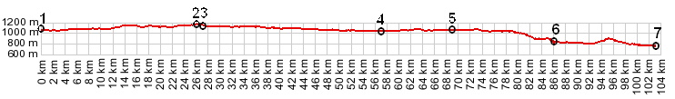
Yellowhead Pass Yellowhead Pass is the
lowest continental divide crossing in the
Canadian Rockies. A major traffic artery is
the result, but not quite as major as one
might expect at first. The pass is also a
great cycling route between Alberta and
British Columbia. This is one pass where the
major attractions are on either end, while
crossing the top is relatively
anticlimactic. More details about a ride and
the history of Yellowhead Pass are here,
under the heading "almost but not quite -
the history of Yellowhead Pass".
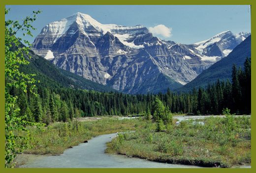
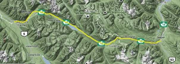 Approaches From West. The major attraction along
the pass is near the beginning of this
approach, the sight of Mount Robson. This peak
has the highest elevation gain from its base (
called prominence ) of any peak in the entire
Rocky Mountains, approximately 3000 meters on
the south side, not far from the highway. At
3954 meters (12972ft) Mount Robson is also the
highest mountain of the Canadian Rockies, even
though there are higher peaks to the west in
the coastal ranges.
From East. On this side also, the
most popular attraction is on the bottom, the
town of Jasper with its surrounding scenic
attractions. The grade is so gentle that wind
is often more of a factor than grade, while on
a ride to the top. Impressive peaks float by
in the upper field of vision. The pass sign is
located on the Alberta - BC province boundary.
But the road seems to keep on climbing ever so
slightly and then stays nearly flat for many
miles. Some maps mark the pass a short
distance within British Columbia.
Tours Dayrides. An out and back ride
from Jasper to the flat summit area as far as
Moose River Crossing measured 75 miles with
2050 feet of climbing over 4.4 hours. An out
and back ride to the same destination from the
opposite direction, starting in Tete Jeune
Cache measured 80 miles with 3800 feet of
climbing in 5.2 hours, using the same setup
(Cateye 100AT m3:04.07.21-22). 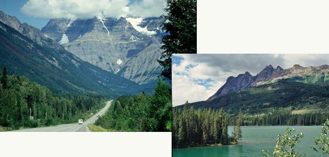 |