|
|||||||||||||||||
|
|
|||||||||||||||||
| |
|
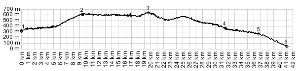
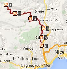
D1 Bouyon(sh)
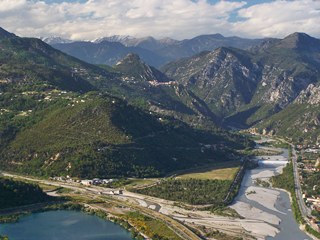
The route to this shoulder summit runs along a high ridge,
next to the river Var. Along the way it collects all the
hilltowns which look so enticing, when cycling along the
river. Especially on the eastern side, this is an urban
environment, and there are close to infinitely many ways to
reach the summit point from the east. But this is the most
obvious way.
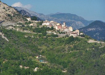
The western side, on the other hand, is already a world removed from the urban congestion of Nice, with even more towns on rocky perches wait to be discovered from the seat of a bicycle. 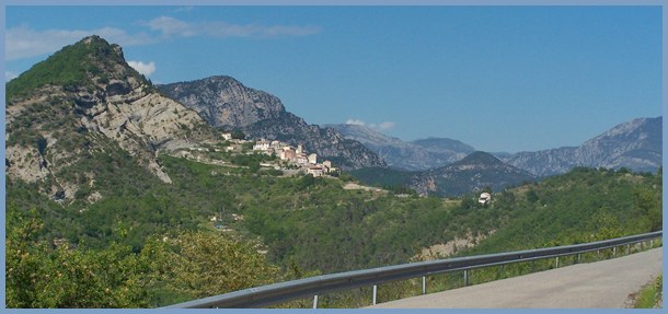
That will have to do for medieval village viewing until the
road gets to what feels like a summit. In dense forest without
any sign of traffic it heads up to a gap between two hogback
ridges. Consegudes sits slightly above the gap, as if to show
"this perch is occupied". However the road does not
really descend form here, but traverses along the ridge,
directly across from D27 to
Ascros. From this vantage point with good late light, the
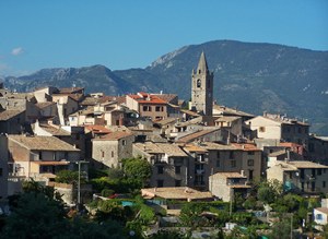
view of the zigzags up Mt Dial are especially impressive. The next medieval outpost, Ferres, lies at the junction of
two different rock outcrops. To descend the Col de Ferres (just
a shoulder point along this route) would require dirt road or
trail on the north side. Taking the right fork in Bouyon would
traverse a higher point on the way to Consegules. But the route
profiled here, stays left and reaches an almost imperceptible
high point along the uninterrupted viewing platform the road has
been following.
From East. (described downwards)
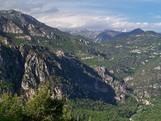
Approximately at the summit traffic picks up considerably, and
it all comes or goes to the coast. There are many ways descend
from here. The scenically most interesting way is to stick to
the ridge line and pick up more hilltowns. Their character is
different from here eastwards. Yes - the origin of the towns is
still medieval, but they have flourishing modern life in them.
They are busy with businesses, creperies and tourists, and they
are surrounded by hundreds of modern one family real estate
investments. But you can still find the picture perfect pictre
frame around them, so that the illusion of a picturesque distant
past is preserved. And if the weather plays along, there is a
perfect snowy mountain background too. The daytrip below stays
along the ridge a little longer than the profile. But it also
has more traffic. More detail and options to descend on this
side are on the D1-D2209
Carros Village (sh) page A Dayride with this point as intermediate summit
is on page D27 Ascros s(u)
|
|
|
advertisement |
|
|
advertisement |