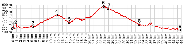
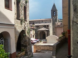
D32 Utelle s(u)
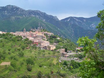
It is not very often, that there is a medieval town square -
near, or right on top of a summit. D32 actually has two
spots that fit this description, and this one is the higher
of the two. The description continues from The D32
La Tour summit(u)
|
1.(00.0km,214m)
Vars Gorge, tunnel entrance on D
2.(00.3km,217m) START-STOP WEST: profile turns left up
Valley of the Tinee
3.(05.3km,244m) profile turns right up to La Tour
4.(11.5km,595m) D32 La Tour s(u)
5.(14.7km,375m) low point between D32 La Tour s(u) and
D32 Utelle s(u)
6.(23.8km,878m) TOP: D32 Utelle s(u) at turnoff to out
and back road to Crete de la Madone
7.(24.8km,795m) western turnoff into Utelle
8.(33.2km,281m) START-STOP EAST ALT: profile turns
right down Vesubie Gorge
9.(43.8km,142m) START-STOP EAST: jct Vesubie Gorge -
Vars Gorge |
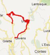 Approaches Approaches
From West. There is no control point in google maps at
the top of la Tour. So the actual elevation may be a little
higher than indicated on the profile. After climbing to the
medieval town of La Tour, D32 descends again and then climbs on
a road with quite a few rocks on them, to the even more
precariously located town of Utelle. The road is quite rough,
has many small ups and downs as well as rock remaining from
slides. It is also lined with abandoned cars now and then. There
are two tunnels near the top. An out and back to the top of the
mountains adds several hundred feet more elevation gain. But the
view from the terrace parking lot outside the town is already
pretty stunning. Once in the town square, you would never guess
you are on top of a cliff. There should be a gite a little
lower, but it either was closed or full when I passed through
here. In any case I had to continue down.
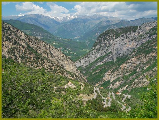
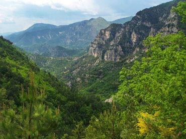
Valley of the Vesubie, while descending east side of Utelle
From East. Quick descend to D2565 and the Gorges de la
Vesubie. The road clinging to the cliffs below to the south is
one approach to the D19 Levens
shoulder summit. Another great view has about eight
switchbacks of this descend in the foreground with the main
range of the Mercantour national park behind it.
|
|
|
Utelle from summit
|
Utelle townsquare
|
|
|
|
D19 Levens s(u) from
eastern approach
to Utelle s(u)
|
lower western approach
to Utelle
|
A day on an Extended Tour:
(<D32
La Tour s(u)|Col
de Turini>)
D32 Utelle s(u) , D32 La Tour
s(u) , D26 Tournefort
s(u): Entrevaux > N202 east > D26 Tournefort s(u) >
D32 La Tour s(u) > D32 Utelle s(u) > D2565 north >
Lantosque: 55.2miles with 5290ft of climbing in 5:37 hours on a
fully loaded mountain bike (m4:12.5.24).
A dayride from the ending point of that day, Lantosque, is on
page: Col St Martin
back to Cycling
Passes in Europe
|