| |
|
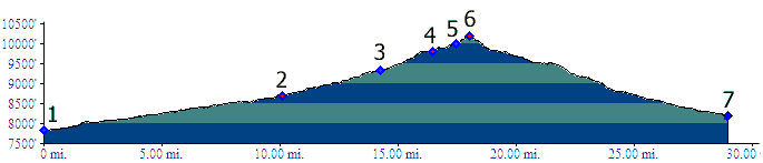
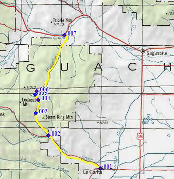
1. (7830ft,mile00) START-END SOUTH ALTERNATE: jct 38rd -41G rd just west of La Garita. Profile follows northern route at the fork.
2.(8690ft,mile11) START-END SOUTH: Profile goes right. Left goes to Moon Pass
3.(9330ft,mile15) turnoff to Storm King Campground on right.
4.(9800ft,mile17) on left is FR786. Profiled route stays straight
5.(10000ft,mile19) left goes to Lookout Mtn. Profile stays right
6.(10166ft,mile19) TOP: Carnero Pass
7.(8200ft,mile29) START-END NORTH: jct Co114 - road to Carnero Pass