| |
|
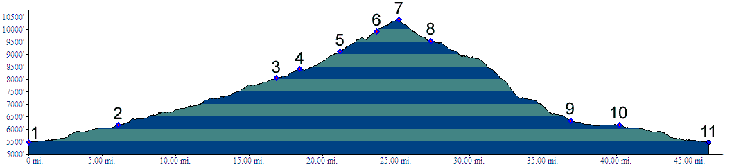
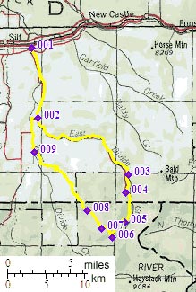
01.(5470ft,mile00) START-END EAST: jct: Divide Creek road - county road on south side of Colorado River, 5 miles west of New Castle
02.(6160ft,mile06) stay left along East Divide Creek
03.(8050ft,mile17) jct with Road Gulch on left
04.(8410ft,mile19) jct with trail up Camp Creek, labeled Flagpole Mtn loop on left
05.(9110ft,mile22) profile stays right up towards Coal Ridge
06.(9910ft,mile25) T junction with improved dirt road, stay right
07.(10400ft,mile26) TOP
08.(9530ft,mile28) junction with route to Horse Park and 2nd dirt road downhill on left
09.(6330ft,mile37) route joins road down Alkali Creek
10.(6160ft,mile41) same as point 2
11.(5470ft,mile47) START-END WEST: same as point 1