| |
|
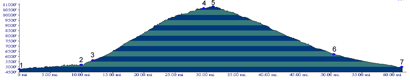
1.(4780ft,mile00) START-END NORTH: Co65 leaves I70 and follows canyon of Plateau Creek
2.(5180ft,mile10) junction with de Beque cutoff; take the right fork here and at the next junction, following shortly thereafter
3.(5640ft,mile12) town of Mesa
4.(10650ft,mile30) Land's End road leaves on right
5.(10839ft,mile32) TOP: Grand Mesa summit(u)
6.(6220ft,mile51) town of Cedaredge
7.(5000ft,mile62) START-END SOUTH: junction with Co97, turn right for Delta
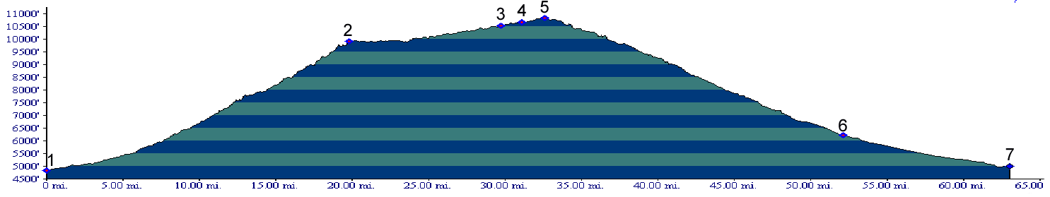
1.(4840ft,mile00) START-END WEST: Land's End road leaves US50 south east of Whitewater
2.(9930ft,mile20) Land's End observatory is 1/4 mile off route to left
3.(10530ft,mile30) junction with alternate route over Anderson Res.
4.(10650ft,mile32) Land's End road joins principal eastern approach.
5.(10839ft,mile34) TOP: high point
6.(6220ft,mile53) town of Cedaredge
7.(5000ft,mile63) START-END SOUTH: junction with Co97, turn right for Delta
