| |
|
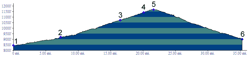
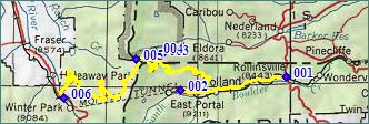
1.(8440ft,mile00) START-END EAST: Rollinsville
2.(9210ft,mile08) START-END EAST ALTERNATE: turn right up hill near East Portal
3.(10730ft,mile17) portage around Needle's Eye tunnel turns right off pass road. Profile continues on pass road, but portage may be necessary.
4.(11410ft,mile20) protage trail around tunnel rejoins pass road
5.11677ft,mile22) TOP: Rollins Pass
6.(9010ft,mile36) START-END WEST: Rollins Pass turnoff, north of Winter Park