| |
|
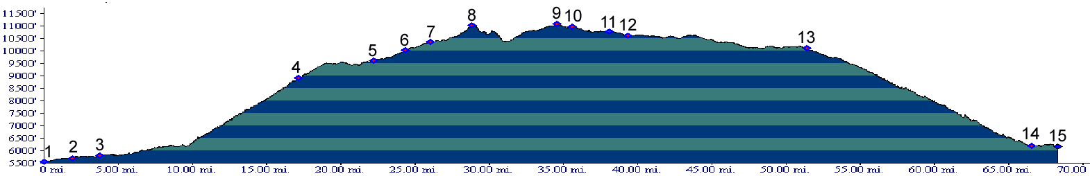
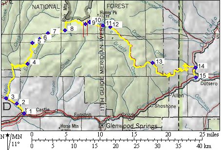
01.(5560ft,mile00) START-END
WEST: New Castle
02.(5700ft,mile02) right fork goes up East Elk Creek. Go straight.
03.(5800ft,mile04) go right up Clinetop Road following Main Fork Elk Creek.
04.(8920ft,mile18) Windy Point
05.(9610ft,mile23) take right onto jeep trail
06.(10040ft,mile25) jeep trail joins from left. Continue straight.
07.(10370ft,mile27) jeep trail joins from left. Continue straight.
08.(11040ft,mile30) first high point. trail begins a rough section, crossing a gulch containing two lakes.
09.(11070ft,mile35) TOP: high point
10.(10970ft,mile36) begin dirt road near Bison Lake
11.(10760ft,mile39) turn off to Supply Basin campground
12.(10600ft,mile39) turn right onto Coffee Pot Road (unpaved).
13.(10110ft,mile52) turnoff to Deep Creek Overlook is on left.
14.(6190ft,mile67) turn right onto Colorado River Road, also called Dotsero Cutoff (paved).
15.(6170ft,mile69) START-END EAST: Dotsero