| |
|
|
|
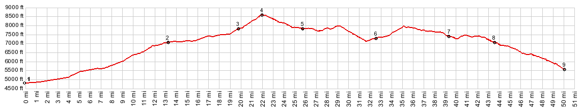
1.(4790ft,mile00.0) START-END EAST: jct Nv88 - Nv206 (Fairview Lane), south of Minden, Carson Valley
2.(7080ft,13.2mile) jct with Ca89 to Luther Pass on right
3.(7830ft,19.9mile) jct with Red Vista Rd and rd to Forestdale Divide on left
4.(8574ft,mile22.0) TOP: Carson Pass
5.(7830ft,mile25.7) road reaches Caples Lake
6.(7300ft,mile32.7)road reaches Silver Lake
7.(7450ft,mile39.4) profile turns right off Ca89 onto Mormon Emigrant Trail
8.(8000ft,43.6mile) profile turns right onto Silver Fork Rd
9.(5610ft,mile50.1) START-END WEST: Silver Fork Rd crosses American River
| |
![]()