| |
|
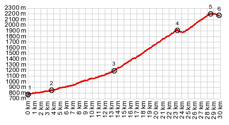
1.(00.0km,0780m) START-END NORTH:camping
de Loustou, Vielle Aure
2.(03.8km,0850m)Lary-St-Soulan
3.(13.4km,1190m)Route des Lacs branches off D113
4.(23.3km,1910m)route to Lac d'Aubert branches off
route to Cap de Long
5.(28.5km,2200m)TOP: Lac d'Aumart
6.(29.8km,2160m)end of road at Lac d'Aubert
|
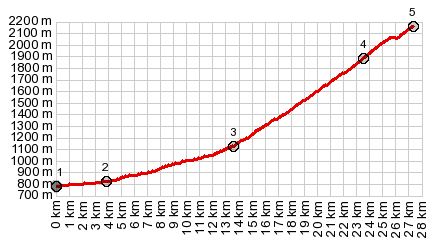
1.(00.0km,0780m) START-END NORTH:camping de Loustou, Vielle Aure
2.(03.8km,0850m)Lary-St-Soulan
3.(13.4km,1190m)Route des Lacs branches off D113
4.(23.3km,1910m)route to Lac d'Aubert branches off route to Cap de Long
5.(27.0km,m,2160)TOP:Barrage de Lac de Cap de Long
|