| |
|
|
|
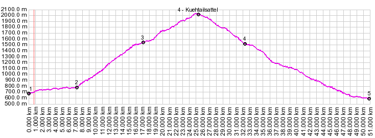
01.(00.0km,698m) START-END WEST: Oetztal Bahnhof
02.(07.0km,792m) route turns up towards Kuehtail away from Oetztal Bundesstrasse.
03.(16.9km,1538m) Ochsengarten
04.(24.8kim,2017m) TOP: Kuehtaisattel
05.(32.0km,1528m) Sankt Sigmund
06.(50.4km,597m) START-END EAST: jct Inntal bike path - Sellrainer Strasse, just north of Kermaten
| |