| |
|
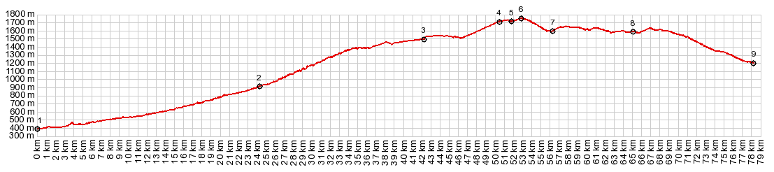
1.(00.0km,0400m)START-END EAST:jct D117 -
D118, north of Axat
2.(24.3km,0910m)jct with D26 to Carcanieres
3.(42.3km,1500m)Formigueres
4.(50.6km,1710m)profile turns right onto D32 at Col de
la Quillane
5.(51.9km,1720m)profile turns left onto D32a
6.(53.0km,1760m)TOP: Col de Mel
7.(56.3km,1600m)profile goes right onto Route de
Artigues, near Mont Louis
8.(65.2km,1590m)route goes through Bolquere
9.(78.1km,1220m)START-END WEST: jct with N20 in Ur
|