|
|
|
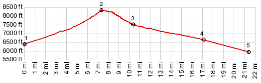
1.START-END WEST: jct US93 - Doublespring
Rd
2.TOP:8320ft, Doublespring Pass
3.jct with route to Horseheaven Pass on right
4,jct with Donkey Hills Rd on right
5.START-END EAST: low point at jct FR118 - Doublesprings
Rd, a few miles before reaching Goldburg
|