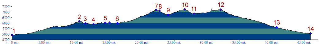
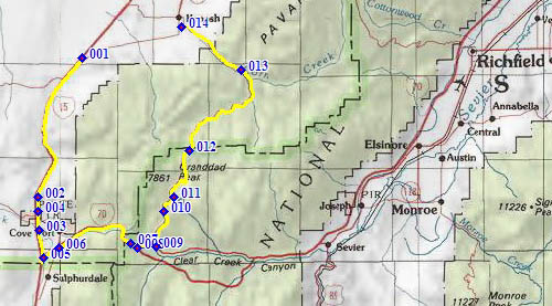
01.(4930ft,mile00) START-END SOUTH: Ut133
joins I15, south east of Kanosh
02.(6160ft,mile11) Cove Fort - Dog Valley Pass
03.(5970ft,mile12) I15 Fort Cove exit
04.(5920ft,mile13) intermediate low point
05.(6040ft,mile15) profile exits I15 onto I70
06.(6000ft,mile17) I70 Fort Cove exit
07.(7190ft,mile23) I70 Clear Creek Road exit Summit
08.(7110ft,mile23) profile exits I70 onto Clear Creek
Road
09.(6400ft,mile24) route turns left onto FR106
10.(7250ft,mile27) TOP
11.(6870ft,mile29) intermediate low point
12.(7220ft,mile33) intermediate high point east of
Mary's Nipple
13.(5600ft,mile41) Adelaide Campground in Kanosh Canyon
14.(5040ft,mile46) START-END NORTH: jct Kanosh Canyon -
Ut133, Kanosh