| |
|
|
|
-
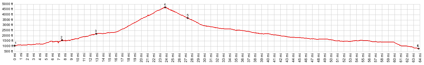
1.(1050ft,mile00.0)START-END SOUTH ALTERNATE: Packwood
2.(1620ft,mile07.6)START-END SOUTH:profile goes left onto Wa123, while right goes to White Pass
3.(2260ft,mile13.0)jct with Stevens Canyon Rd to Paradise on left
4.(4675ft,mile23.9)TOP: Cayuse Pass
5.(3790ft,mile27.1)jct with Paradise Rd on left
6.(750ft,mile63.6)jct WA410-284th Ave ,just west of Enumclaw
|
|
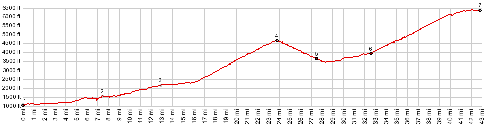
1.(1050ft,mile00.0)START-END SOUTH ALTERNATE: Packwood
2.(1620ft,mile07.6)START-END SOUTH:profile goes left
onto Wa123, while right goes to White Pass
3.(2260ft,mile13.0)jct with Stevens Canyon Rd to
Paradise on left
4.(4675ft,mile23.9)Cayuse Pass
5.(3790ft,mile27.1)profile turns left onto Paradise Rd
6.(4000ft,mile32.7)turnoff to East Fork White River
campground on left
7.(6390ft,mile42.9)START-END TOP: end of road at
Sunrise Visitor Center
-