| |
| |
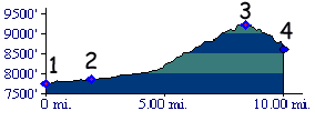
Battle Hill Summit
Road bikers go over this summit
on their way to Tennessee
Pass. It is actually the steepest and
longest part of the succession of climbs to the
Tennesee Pass summit (even if it is not very steep
and long) . But Battle Hill Summit is also a
summit in its own right. It's the missing link to
make loop rides out of many unpaved passes and
summits in the northern Gore Range.
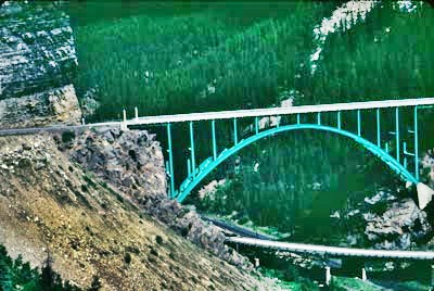
From North. Near the top of the summit an aura of historic decay oozes over the tourist. Abandoned housing from mining workers look fit enough for a movie set, staging the Great Depression. Amazingly the houses on the cliff don't slide off. They still cling to the edges after all this time. From South. (also described upwards) The
bridge, pictured in the middle, makes an imposing
landmark at the beginning of the southern ascent.
But it disappears below quickly. On the way up you
catch interesting glimpses of peaks in the Holy
Cross group, all part of the Gore Range, as well
as the old railbed in the depths below Dayride with this point as highest summit PARTIALLY PAVED / UNPAVED
Hayden Survey (<Tennesee Pass|Yellowjacket Pass>)
You cannot get a good view of Mount Holy Cross
from Battle Hill Summit. But you can get a great
view of the mountain, that made the view of Mount
Holy Cross famous, and that is Notch Mountain. You
can't miss the sign pointing towards the left and
into the sky, when climbing Battle Hill Summit
from the north side. In the 1880s the American West had a new
religious icon, the striking image of a cross on a
mountain face. A segment of population in the
eastern cities became so mystified by this, that
its exploration became a major obje Subsequently the pilgrimages reportedly numbered
in the hundreds, and amongst them are the ususal
reported faith healings. Western landscape painter
Thomas Moran also painted the mountain. Mount Holy
Cross was a designated national monument between
1929 and after WW2, when interest declined. Mining. The history of the mine which is
visible along this route dates from 1879 to the
1970s. The New Jersey Zinc company was the final
entity to operate it before going out of business.
|
|||||||||||||||||||||||||||||||||||||||
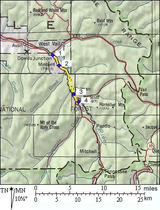 Approaches
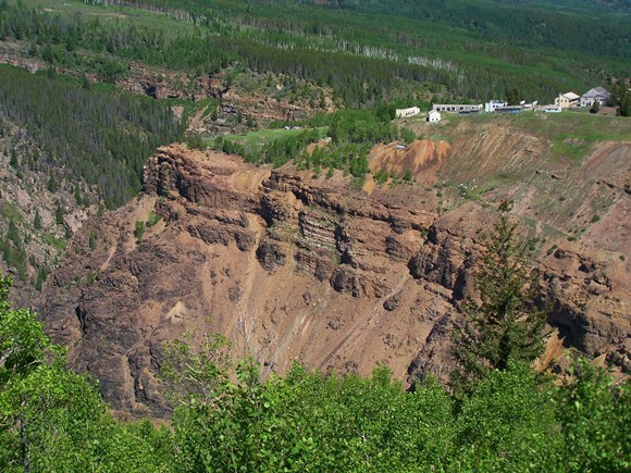
 History
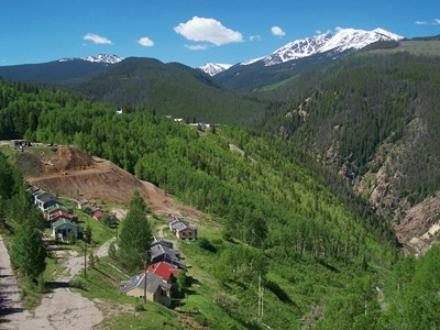 ctive
of the Hayden Survey of 1873. The team located the
mountain north west of Tennesee Pass, and on
August 22nd, the well known survey photographer HW
Jackson took the photo that would make the
mountain famous from the top of Notch Mountain.
The Hayden Survey triangulated the peak at 13999
feet, which is amazingly close to today's official
number of 14005 feet. These six feet account for
thousands of subsequent visits of 14er climbers.
ctive
of the Hayden Survey of 1873. The team located the
mountain north west of Tennesee Pass, and on
August 22nd, the well known survey photographer HW
Jackson took the photo that would make the
mountain famous from the top of Notch Mountain.
The Hayden Survey triangulated the peak at 13999
feet, which is amazingly close to today's official
number of 14005 feet. These six feet account for
thousands of subsequent visits of 14er climbers.|
|
advertisement |
|
|
advertisement |