| |
| |
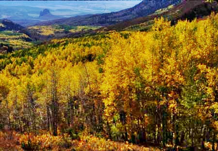
Interocean Pass Interocean Pass is a trail in the
West Elk Mountains, that is relatively little
known to mountain bikers. But this trail really
shows off the scenic specialties of this area,
which is a combination of montane, canyon and
plateau characteristics. The top of the pass is
below treeline. But there are still some great
views along the way.
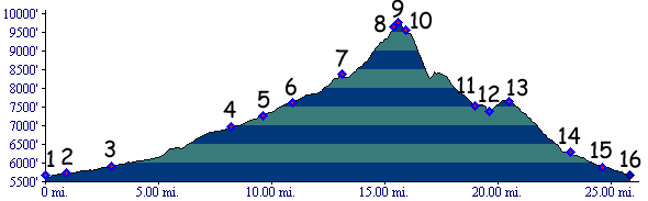
The southern approach has many good vantage points onto the West Elk Mountains, glowing with streaks of red in late light. On the other side, the northern approach leads by a rock monument, surrounded by farms instead of tourist trappings. The track is not forbiddingly steep in the north to south direction (just very steep), and I remember it as being relatively smooth (but it has been a while). Most of the jeep trail sections contain fewer rocks than many other high Colorado passes. The major exception to everything above is the steep rocky grade below point 10. The pass is not on the continental divide, as might be inferred by the name.
From South. The profile
starts at the turnoff onto G00 Drive, roughly 5
miles north of Crawford, on 39.00 Rd. The main
scenic attraction of the whole route may well be
before the climb starts. South of Landsend Peak,
surrounded by farms, stands the outline of rock
that looks like a volcanic plug, named Neede Rock.
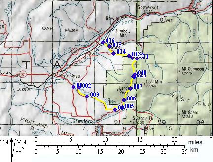
Dayride Interocean Pass : near jct
39.00rd - Co92 > 39.00rd west > Needle Rock
> up Interocean Pass Tr > Interocean Pass
> Paonia > Co92 back to starting point: 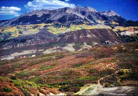 - |
 Approaches
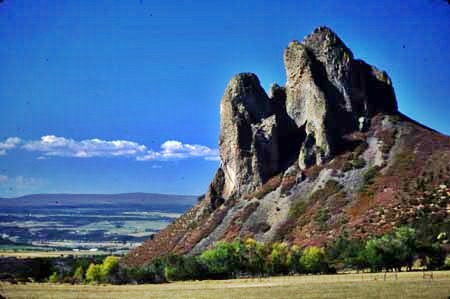
|
|
advertisement |
|
|
advertisement |