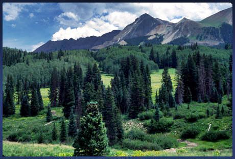
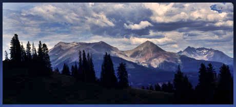
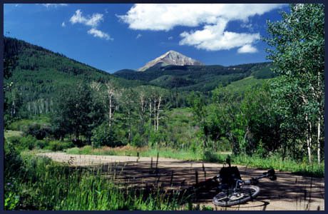
>>
-
-

<<
-
-
TOP NAV reset map list all ??


advertisement

Lone Cone Pass 

One of the nicest things about the Lone Cone Pass route is its peacefulness. The area is still blessedly unaffected by the off road motor craze. In recent years it seems that Colorado has become a testing ground for motorheads and their latest contraptions, so that sometimes it seems that five dollar a gallon gasoline wouldn't be such a bad thing after all. Lone Cone Pass has the power to correct these perceptions. The route is blessedly unaffected by loud noise, and after traversing the pass,  you may feel at peace with the internal combustion engine again. If you run into another vehicle up here it is likely to be a beat up old ranch truck instead of a lawnmower engine with wheels, and if you hear "noise", it's probably a mooing cow.

The route is a scenic ride over a shoulder of the Wilson Mountains. The ride meanders on a plateau between several isolated jagged mountains. The surface for the most part (except where noted on the southern side) lends itself to fast aerobic climbing, ideal practice for road bikers who have run out of new paved mountains, and are looking for steep dirt to provide new challenges.

Lone Cone Pass is not marked on forest service maps, topo maps or directional signs in the area. Ironically it has been identified by Don Koch in "the Colorado Pass Book", a publication aimed at four wheel drive enthusiasts. However this book also contains good photography and historical information. The pass is also included in Helmuth's "Passes of Colorado".


click on profile for more detail
1.(7120ft,mile00) START-END NORTH: Specie Canyon Road leaves Co145 towards south
2.(8040ft,mile11) low point crossing Beaver Creek
3.(8690ft,mile13) take left from Beef Trail Road towards Lone Cone (same as point 11 in East Lone Cone Pass profile ).
4.(9310ft,mile18) West Beaver Creek road goes right. Stay left.
5.(9100ft,mile21) Beaver Park, stay left (same as point 10 in East Lone Cone Pass profile ).
6.(9810ft,mile25) East Lone Cone Pass road joins on left. Stay right.
7.(11029ft,mile29) TOP: Lone Cone Pass
8.(10650ft,mile31) Route joins with approach described for East Lone Cone Pass. Go left. (same as point 5 in East Lone Cone Pass profile).
9.(10160ft,mile37) East Lone Cone Pass trail joins on left. Go straight. (same as point 8 in East Lone Cone Pass profile ).
10.(8890ft,mile41) START-END SOUTH: site of Dunton Guard Station

Approaches

From North. Many approaches are possible. The route suggested on this profile is more of a roller coaster than a steady ascent to the summit. This is however typical of the area, where to peaks sit on top of a plateau. The ride starts with a steep smooth dirt road climb, leaving from Co145, up Specie Canyon. Once on top of the plateau, the ride leads past large ranches on Beef Trail Road. The first impressive background is the north side of the group of mountains containing Mount Wilson and El Diente. In order to pick up FR611, Beef Trail Road has to decend to Beaver Creek and its willow shaded, densely forest area. After climbing back up the plateau, the left turn onto FR611 is only marked with a sign "Beaver Park". The second peak, on this circumbikulation of three mountains, comes into sight, Lone Cone, presenting the image of a lone isosceles triangle in the sky. The road begins a regular orgy of switchbacks, finally heading through Beaver Park towards the third of the magnificent three, Dolores Peak (13290ft) in the Wilson mountains. After spending so much time riding through open meadows, climbing ever higher, it comes as a surprise that the summit is densely forested. The top of the pass is marked by a short section of exceedingly rough road surface, which presents no problem to the cyclist but deters other travelers.


From South. The southern approach is described in a downward direction to facilitate description of the suggested dayride. Large switchbacks descend the south side. They look impressive on the map but are really quite shallow and a joy to coast. The western end of each switchback presents a new panorama onto the San Miguel mtns. After a grand meandering tour of the northern Fish Creek drainages at around 10000 feet, the smooth, but little traveled dirt road changes character. With bumps and a coating of gravel it descends steeply to the West Dolores River. Descending the pass further leads to Dunton along the West Dolores River. This is where the profile ends. The suggested dayride turns left here and the description is completed in the dayrides section.


Tours

Dayrides. The two described approaches to Lone Cone Pass can be connected into a circular dayride by completing the route over paved Lizard Head Pass. The description continues from the end of the southern profile. After arriving on the West Dolores River, two miles north of Dunton, there remains another unnamed ridge to be crossed. This crest reaches back up to 10000 feet and the western approach can be quite gravely and bumpy. After that all that remains is a short climb to the top of Lizard Head Pass, followed by a long, shallow rolling descent to the starting point. The ride measured 87 miles, 8580 feet total climbing and 8.28 hours, using an Cateye100A cycle computer.


back to Colorado Pass Tables Page


-------
Copyright (C) by Michael Fiebach 2003-2011
-------