Mount
Vernon Canyon - Genesee Trail Rd. shoulder
summit
Highest Point: 7740ft
|
| Eastern Approach 1: |
|
|
| from jct Clear Creek bike
path - Kipling Ave, Wheat Ridge (5360ft) |
2380ft |
15+1/2miles |
| from jct I70 - West Colfax
Ave (US40) (5800ft) |
1940ft |
9miles |
| Eastern Approach 2: |
|
|
| from jct I70 - Grapevine Road
(7160ft) |
580ft |
3+1/2miles |
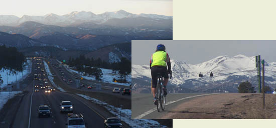
The bridge over I70 at the
Genesee Exit is the highest point, when combining
a climb up Mount Vernon Canyon Rd. (or Lookout Mtn
Rd) with a descent down the other side of I70 on
Genesee Trail Rd. If instead continuing on the
shoulder of I70, the route goes over higher
points. Picture on left is taken from that bridge,
looking to continental divide during dusk. Picture
on right shows the I70 service road approaching
the bridge.
|