| |
| |
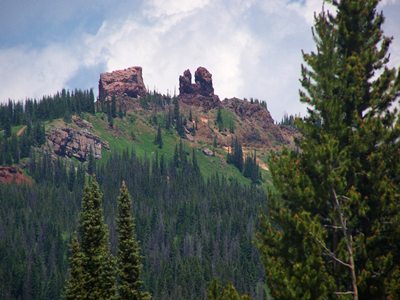
Old Rabbit Ears Pass
An old section of highway runs
parallel to Rabbit Ears Pass at the top. Surprise
- that's Old Rabbit Ears Pass. You can drive or
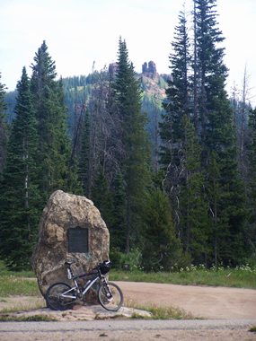
ride a road bike to the old summit and the small
historic monument there. A number of interesting
mountain bike routes start here. With a mountain
bike you can also make a loop over the entire few
miles of the old pass road. Since access to one
side of the old highway is blocked, this is not
very practical with a road bike.
From East. (described
downwards). The pavement continues down the other
side, but quickly deteriorates into a dirt road.
The final section of the road is closed by a
barrier. But with a mountain bike or on foot you
are free to continue on the old roadbed, now
overgrown with grass. The route merges with the
new Rabbit Pass Road, located on the other side of
another barrier. Traveling on the highway this
spot is very hard to recognize, unless you have
seen it from the other side first. 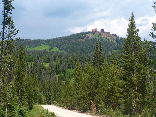
History The Rabbit Pass area was first mapped by the
Hayden Survey in 1876. The first road, following
prospector trails followed the same year. The next version of the road, still surfaced with
dirt dates back to 1914. It was suitable for
automobiles. The route over the current Rabbit
Ears Pass opened in 1959 after two years of
construction.
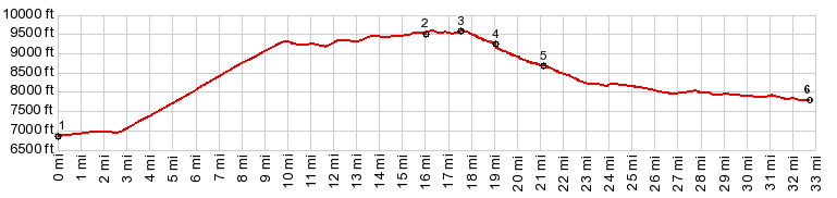
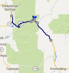
 Ride with this point as highest summit: PARTIALLY PAVED / UNPAVED / SINGLE TRACK (<Co134 near Toponas s(u) | Wyoming Trail s(u) >) Old Rabbit Ears Pass , Rabbit Ears Pass : A short distance south on FR100, off Rabbit Ears Pass : FR100 north > Muddy Creek Trailhead > Old Rabbit Ears Pass <> two out and backs up towards Rabbit Ears Peak, looking for a trail around the east side of the peak <> separate out and back on FR311 to turnaround point at trailhead for Wyoming Trail >> down US40 to Stramboat Springs > a mile or two around Streamboat Springs > back up US40 and FR110 back to starting point: 63.5miles with 5700ft of climbing in 6:23hrs (Garmin etrex30 15.7.2) Notes: Anything but the planned route: First I couldn't find a trail around the east side of Rabbit Ears Peak towards Buffalo Pass. Then the brakeshoes failed at the Wyoming trailhead, so I rode to Steamboat on pavement to get new ones. |
|
|
advertisement |
|
|
advertisement |