| |
| |
Col des Ares
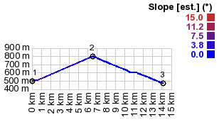
This is a gentle pass, that can
easily show up as a final surprise in loops over
higher summits. It is still honored with the
informational signs showing slope, and remaining
climbing elevation directed especially towards
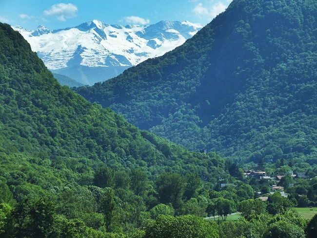
cyclists. The nice views are on the south side.
Here is a large restaurant that also provides
some campsites at the very apex of the pass, at
the exact spot, where you catch the first glimpse
of the the valley to the north and the high peaks
behind it.
From West. (described
downwards). This side has a greater variety of
views. A fast, only slightly curving descent
levels in on Chaum and its narrow streets. In the
background to the left are the first glimpses of
snow covered peaks.
 A Dayride with this point as intermediate summit is on page: Col de Mente History Cycling - Tour de France: This little pass has been on a Tour de France stage an incredible 27 times since 1947. It is a safe bet that most or all of these stages went over higher summits. Routes with anchor point in Toulouse and Luchon appeared 5 times each, Carcasonne and Luchon 4 times each. The remaining routes all have different anchor points, even though Pau is another popular end/start point. |
|
|
advertisement |
|
|
advertisement |