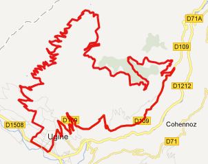
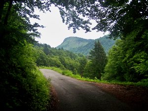
< Left Panel   Passes in French Alps   Areas   Tables   Maps   All Favorites  
Main Panel:   Main Page   Map+Profile   Alps Map  


Col de l'Arpettaz

This is one pass that does not really go anywhere, at least if you do not take the unpaved turnoff at the summit. But in spite of this, or maybe because of this, it makes a great bike ride. - Because - this cuts down on car traffic, that just wants to get from A to B. The route climbs from Ugine, and then descends back to it, or alternatively into the Gorge de l'Arly a little upstream from this town. There seem to be about equal proportions of car, motorcycle and bicycle traffic on this little road. I counted one of each, including myself. Maybe this road does not get much bicycle traffic because there are so many cycle climbing destinations to choose from close by, or because the pavement is a little rough in places.


1.(00.0km,412m) START-END 1: Ugine,
2.(15.7km,1581m) TOP: Col de l'Arpettaz
3.(28.9km,970m) profile continues straight here; left leads to the Gorge of the Arly further north
4.(40.1km,412m) START-END 2: same as point 1

Approaches

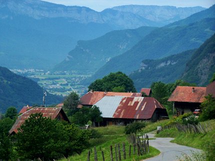
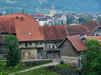
From South. If approaching the starting point of the profile, Ugine, while coming down the Col de la Forclaz, you just cross N212 in the Gorge de l'Arly on the outskirts of Ugine, and then start climbing again. A sign points the way. To the left within short distance are two supermarkets, a bakery, a vegetable store and many other businesses.

The switchbacks never stop, either on the way or on the way down. The only thing that changes is what's next to the switchbacks. After leaving behind the church and huddled together farmhouses of upper Ugine, more loosely spaced older farm houses adjoin the road. It appears that this scene is going to last all the way up, but it's just the lower part. A middle section goes through beautiful dense growth forest. A nice pique-nique bench on an open sub alpine meadow, presents a view up the valley of the Chamfroid and the steep little "Dent de Cons" (2064m) behine Urgine. From here it's not very far to the top, the site of refuge behind a small col sign. A unpaved "route des montanges" continues traversing below the the long, continuous face of the "Chaine des Aravis" and connects to the Col des Aravis. It looks very inviting. But the profile continues along the paved option. It climbs just a little higher than the pass and the turns west to descend.

Col de l'Aprepettaz
telephoto view of Mont Blanc Massif from western approach to Col de l'Arpettaz

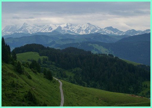
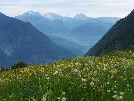
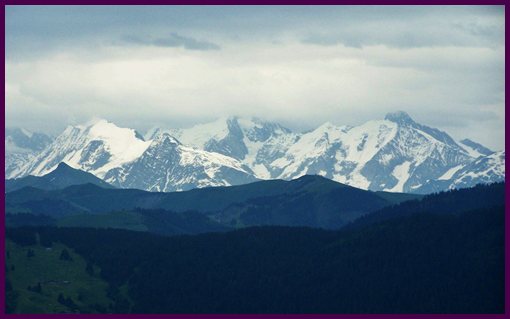
From West. (described downwards). At first the viewshed looks almost the same as on the climb. But then a few longer switchbacks take in more of the western side, with more views of the Mont Blanc Massif. The jagged triangles of ice and snow loom above the villages, hanging on the slope of the Gorge de l'Arly. After the best views disappear there is an option to descend south directly back to Ugine or north to the Gorge de l'Arly direction Flumet.
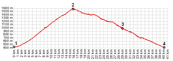
Col de l'Arpettaz

left: climbing above the rusty roofs of Ugine, on the way to Col de l'Arpettaz

below left:
getting closer to the summit from the south

Col de
                              l'Arpettaz

Ugine from Col de l'Arpettaz
                              approach


Col de l'Arpettaz

top right:
Ugine

left: valley of the Chamfroid, east of Col de l'Arpettaz


Dayride with this point as highest summit:

Col de l'Arpettaz, Col de la Forclaz x2: Queige > Col de la Forclaz > Ugine > Col de l'Arpettaz > Hery > Ugine > Col de la Forclaz > sp: 42.9miles with 6410ft of climbing in 4:40hrs (VDO MC1.0 m4:12.6.18)
Notes: a longer ride was planned but the weather deteriorated in the afternoon.

The last pass with different starting and end points on this Extended Tour was: Cormet de Roselend

Mont Blanc from Col de l'Arpettaz
the sun is slowly returning to Mont Blanc


advertisement

advertisement