| |
| |
Calar Alto s(u)
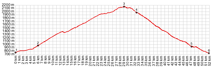
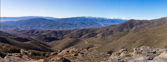
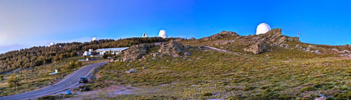
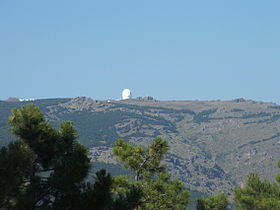
The first time I saw the summit of Calar Alto, I really had no idea what I was looking at. I didn't know, that I was looking at one of the reasons why I wanted to bike along the dessert valley of the Rio Nacimiento. Shining in perfectly blue polarized light a strange manmade object sat on top of a breadloaf shaped ridge. It did not look very high on this perfectly clear day. But it actually reaches above 2000 meters, and it is the highest peak in the Sierra Filabres. The strange looking little dot on top is a telescope. Also the word peak should not be taken literally.
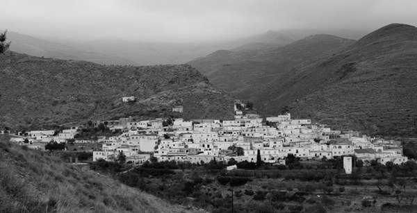
The white village maze of Aulago seems deserted.
It is a very different scene than the pictures of
this village that are linked below. Behind it is a
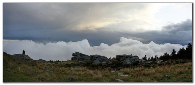
green dessert pyramid, that ends in the clouds
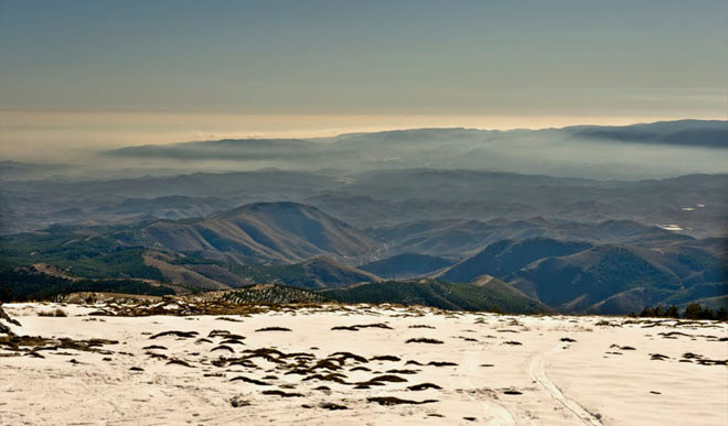
above it. Soon I am riding in the clouds also,
Twice the wind tears them open, and opens a window
on a far sweeping landscape. The soup closes in
again and I see just enough to realize that I am
now riding surrounded by trees. At the top the
clouds tear open again, but just enough to show
several telescopes as jagged white shapes. To me
the scene is actually more impressive than the
alternative, the silent perfect blue sky. A plague
tells of the history of the telescope. Copyrights below pictures:
From East. (described
downwards) A short straight roll along the bumpy,
not too narrow, old road leads to the signed
intersection Venta de Luisa, and the road is
already back in the forest, even though still at
an elevation just barely under 2000 meters. On the
roll back down I pass a mirador, but the view
dissolves into white. By the time I get into a
lower forests my gloves are not not enough any
more to keep my fingers from getting numb and I
start shaking the handlebars. But this goes away
as fast as it came. Back down in Gergal, all is
warm and well.
Dayride with this point as highest point: COMPLETELY PAVED: ( < Puerto
Santillana | Puerto
de Velefique > ) History: The Telescope: The site is a cooperation
between the German Max Planck Institute and the
Institute of Astrophysics of Andalucia. The first
telescope was erected in 1975/76. It is the
largest telescope maintained in mainland Europe.
But there are larger ones on the Balearic island
La Palma. By today four more telescope structures
have been built on Calar Alto.
|
|
|
advertisement |
|
|
advertisement |