| |
| |
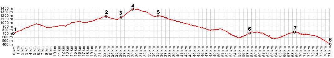
Col de Cornille
I missed this little
pass on the first loop around. The road signs for
the "bucles d'Azur" bicycle route actually signs a
route around it, not over it. Generally the pass
is thought of, only as the section between points
3 and 5. The profile below attempts to connect
this route with points near the coast, still
leaving this pass as the highest point on the
profile. Whatever way this is accomplished, it
involves a lot of extra up and down.
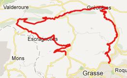
From East. (described downwards). Roll down to jct with D81. This is almost on the route Napoleon, or go right over Col Bas, another very small pass. From West. (described
upwards) From the round-about in Andon at point 5
on the profile, a road sign points up
l'Audibergue, a ski area that is amazingly close
to the Mediterranean sea. I wonder how long it is
actually in operation. Before you get to the ski
area, you can go right at a fork and climb in a
straight line between modern holiday houses and a
few tourist businesses, that however were all
closed. - No medieval scenery on this climb. From
the top you can make out a few far mountains
between the trees.
A Dayride with this point as intermediate summit is on page: Col de Bleine The last summit point with different start and end points on this Extended Tour is: D2 Clues de Greolieres - Plan du Peyron(sh) |
 Approaches
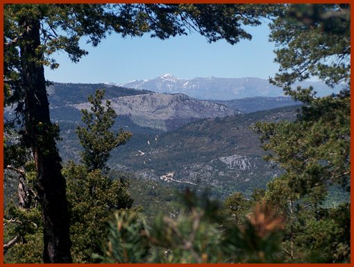
|
|
advertisement |
|
|
advertisement |