| |
| |
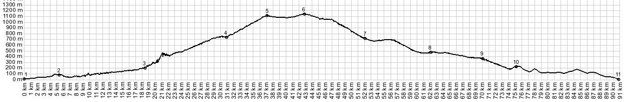
Col de l'Ecre s(u)
Col de l'Ecre is a pass in the
bare, coastal limestone cliffs above Grasse. This
is one way to escape the nightmare coastal
traffic, and get a climbing workout at the same
time. The road reaches a slightly higher altitude
at a different spot, a few km distant from the
pass. - And if you ride over the pass, and stay on
pavement you also have to ride over the summit
point. The point is also higher than the nearby
Col de Sine.
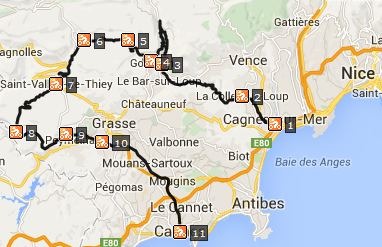
Gourdon is the next next hilltown. It seems to
get quite a few visitors, since it sits on top of
a perch with a zillion people in cars below it.
This can also be the highest point on a loop, when
you combine it with another approach, arriving
directly from Grasse. But - it takes only one more
turnoff up the hill, and the traffic is now only a
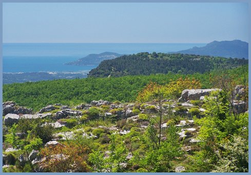
memory. The road quickly passes above treeline,
and the scenery is dominated by horzonatal
limestone layers, that accumulated into massive
ship hull shapes between here and the snow covered
peaks. The pass itself is marked with a sign, and a km
or two away from the edge of the plateau. There
are better views before the summit. The road
descends a miniscule amount into a shallow valley
on top of the plateau. From this shallow valley
one can climb further on a bike to astromical
observertories on the surrounding ridges. The town Cassoules consists of just a few
modern houses next to the road. At the next
junction (right goes to Col de la Sine) the road
reaches about 30 meters higher than the Col.
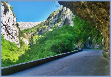
From West. (described downwards). However, this summit point does not have to be traversed when riding to Col de la Sine. There is a traffic triangle here and the direct route to Sine bypasses this point. For the first part the descend is straight and
shallow and through the forest, time to just let
it roll. Then the road takes the step off the
limestone hull with two long ramps connected by
one walled switchback. Here the road passes Col de
Ferrier, which is always a shoulder point (at
least if only considering paved routes) Below the
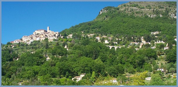
churchtower of St Vallier de Thiey waits in
apparent peaceful surroundings. But that can be
deceiving. Below crosses the Route du Napoleon,
and today Napoleon spells traffic. But the profile postpones Napoleon and traffic a
little longer and heads straight south to St
Cezaire sur Siagne. Some maps mark a Col de la
Legue in this section, but there is no evidence of
an uphill here. This is the place to look back to
where you have been and feel impressed by the size
of the climb. On the other side of St Cezaire a
balcony looks over the remaining lovely wooded
hills to the sea.
COMPLETELY PAVED:
|
|
|
advertisement |
|
|
advertisement |