|
|||||||||||||||||
|
|
|||||||||||||||||
| |
|
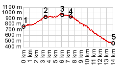
Col de l'Epine
Epine means "thorn", and there are two
"thorn" passes with in fairly close proximity.
Both are about the same altitude, but this one is a little
lower. But the name gives the wrong impression. This road is
not a thorn, but a pure pleasure to ride. Very little
traffic, and if approaching from the north, at the end of a
long day over a choice from the many other passes in the
area, this one is not a severe last blow.
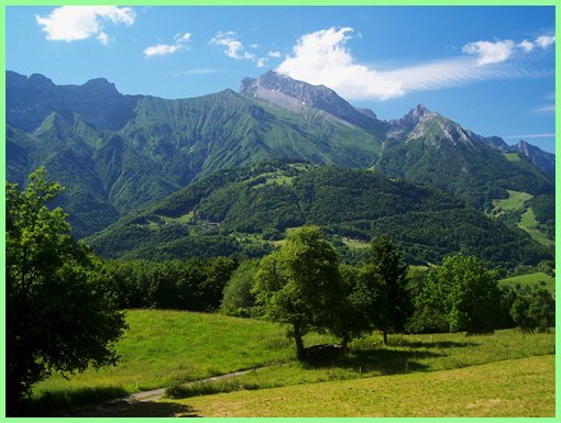
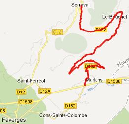
From West. Right across the church in Sarraval a sign
points up this route. The road gently heads up into the lower
parts of the Chaine des Aravis, contouring on the north side of
a wooded ravine, in order to reach the village la Bouchet. Once
this is accomplished, the road crosses this valley, and gently
contours up to the top of the pass. The nicest views, in my
opinion, are just before the top, looking east on to the
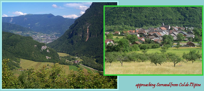
mountain la Tournette (2351m). From East. The sign making another pass crossing
official, comes just a little after the point of highest
altitude. A straight gently road traverses over the summit and
then descends in long ramps to la Marlene. A little further down
the descend the view reaches down valley to Ugine. From Marlene
an immaculately surfaced piste ciclabile, leads parallel to
N508, but separated from it by many meters of grass and bushes,
down into Ugine.
The last pass ride with different start and end points on
this Extended Tour was: Cormet
de Roselend
back to Cycling Passes in Europe
|
 Approaches