| |
| |
Sometimes lower is better. The
Furkajoch does not reach the large rocky expanses
over 2000 meters, as the passes in the central
alps do. This is a greener landscape. But it is
just as sculpted and maybe even richer in colors,
forms and textures - and best of all, it tends to
have much less traffic. This pass is located on
the very northern edge of the alps in the
Bregenzer Wald area.
Approaches From East. B200 climbs steadily
starting at a lowpoint between Alberschwende and
Egg (east of Dornkirch). A completely paved
bikepath, most of the time completely separated
from the road, starts in Egg and goes as far as
Au. Especially nice is the section below Au,
passing through the valley-alm (a sort of ancient,
semi permanent herding village) of Enge. The bike
path and the village are separated by a river from
the busy B200 road. Au is also the junction
between Furkajoch and Hochtannbergpass.
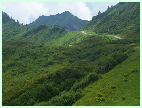
The climb up Furkajoch starts steeply. Turning
around the church of Au lies at the center of the
panorama for at least half an hour. It is the
foreground to a forested hill, that is shaped like
a coin stuck in the sand. Immediately behind this
hill, limestone cliffs tower up into the sky. The
road gradually climbs into a high valley. A long
gallery tunnel comes into view, leading to a pass
top. This is the top of Faschinajoch. The road to
Furkajoch branches off to the right, passing
through Damuels, all services available, including
skiing in the winter. The road climbs above
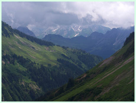
treeline and the top is still 5km away. A panorama
to the south into the "Grosses Walsertal" opens
up, as well as peaks in the Hochtannbergpass
area. These are the best views on the road. The
top contains a small primitive restaurant of
sorts. A plaque informs that this pass has been
used at least since the 14th century, when the
Latensertal on the west side was settled. An old
summit shelter, dating back several hundred years,
has been deconstructed with the construction of
the current road. 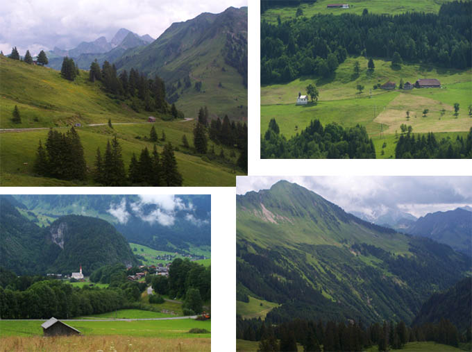 From West. (described downwards) The road
traverses straight down the valley heading south
east. The switchback, visible immediately below
from the pass, is really an access road to a
village. The middle part of the descent is a one
way road with turn outs, without being labeled as
such. It contains a few unsigned, sharp turns that
merit extra attention, especially in oncoming
traffic. In Innterlatens the road becomes a
regular two way road and the peaks on the other
side of the Rhein valley become visible. Two half
km long tunnels are separated only by a few meters
of daylight. An old abandoned road with sharp
dropoffs and plenty of rocks on the road can be
used to ride around the second tunnel. The last
part of the descent is in heavy traffic and full
of switchbacks and houses, descending into the
town of Rankweil.
Dayride
A loop ride starting near Egg ->Mellau ->Au ->Furkajoch ->Rankweil ->Goetzis ->Dornbirn ->Egg measured 73 miles with 6000ft of climbing in 6:3 hours, including about 8 miles due to two wrong turns. The return ride in the Rhein valley has heavy traffic on the roads, but the ride is almost exclusively on bike lanes or paths (m3:9.7.10). There is also a substantial climb after Dornbirn back into the Bergenzer Wald area, on B200, this time without a bike path and also in heavy traffic. |
|||||||||||||||||||||||||||||||||||
|
|
advertisement |
|
|
advertisement |