Col de Gamia
(aka Azkonzabal)
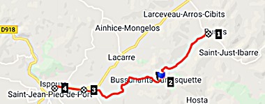
This is a small foothills pass north
of St-Jean-Pied-de-la-Port, that is useful for
avoiding traffic on busy D933, when completing one
of many pass loop possibilities in the foothills
north of St Jean.
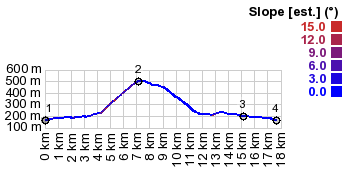 |
1.(00.0km,0160m)
START-END NORTH:low point on D918, just
south of turnoff to Col de Gamia
2.(07.4km,0503m)TOP: Col de Gamia
3.(15.1km,0200m)profile joins busy D933
4.(17.6km,0160m)START-END SOUTH:north end
of St Jean Pied de la Port
|
 Approaches Approaches
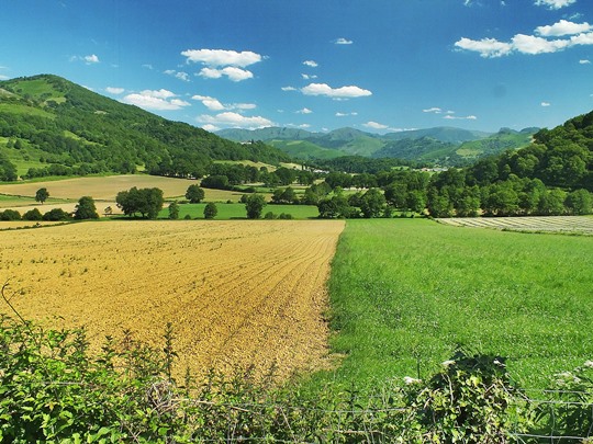
From North. I had the
strange feeling of being back in upper New York
state and bicycling the hill and dales around the
little town of Cobleskill, near Albany. I must
have been very tired near the end of this ride.
But this particular landscape of the lowest
foothills in the Atlantic Pyrenees does bear some
resemblance to the elongated drumlin hills,
smoothed by glaciers and forested, except where
agriculture is practiced. Here too there were
farms and fields below.
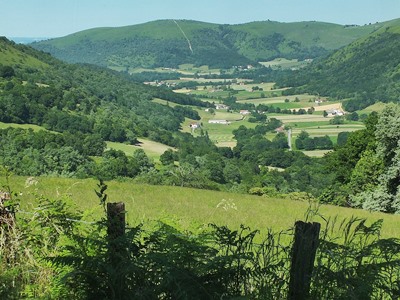 From
South. The top has a great open view of the
valley with St-Jean-Pied-de-la-Port at the foot of
the Atlantic Pyrenees. This view persists part of
the way down. Unfortunately the late hazy light
often obscures this into a flat wall of gray. I
imagine in the morning this must be much better. From
South. The top has a great open view of the
valley with St-Jean-Pied-de-la-Port at the foot of
the Atlantic Pyrenees. This view persists part of
the way down. Unfortunately the late hazy light
often obscures this into a flat wall of gray. I
imagine in the morning this must be much better.
|