| |
| |
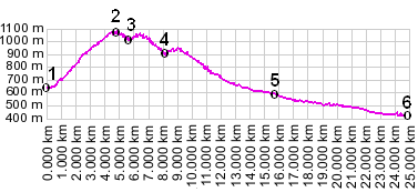
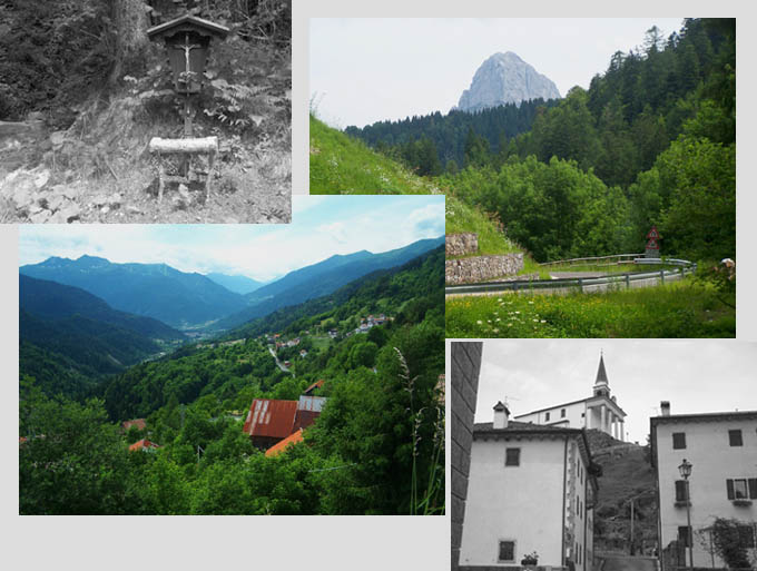
Forcella Lius
This corner of the alps seems to
have quite a few climbs that don't see much
traffic. Some of them are named passes and others
are pleasant country roads like this one.
Approaches From West. The climb joins with the
descend from Passo del Cason di Lanza in the town
of Paulero. Nestled between steep horn like
mountains to the west and the more green canyoned
area to the east, Paulero gives the impression of
having made few concessions to tourism, and has a
pleasant feeling of decay to it. A cascading
mountain stream cuts a deep channel through the
center of town, passing a square with the WW1
memorial statue. The road up this Forcella stays
to the right of the stream leaving town and climbs
a few switchbacks at 18% grade. It passes by a
church and a grave yard with a great view for all
the previously living. The road levels out
somewhat, but still climbs enough that walking is
tempting with a fully loaded mountain bike. It
crests for the first time still in the trees and
rolls down to valley meadow, where a sign labeles
forcella di Lius but at a lower altitude. The road
climbs again in narrow forested switchbacks to
crest where a far peak to the south becomes
visible. From East. (described downwards). This is
one descend where all the switchbacks are flanked
by houses, a church, a graveyard, a spread out
settlement along every curve and straightaway.
Once down in the valley the bike rolls at just the
right speed without the need for breaks to the
town of Paluzza a day on a tour:
(<Pso Cason di Lanza|Ploeckenpass>) A ride with this summit as intermediate summit is on page: Pso Cason di Lanza
|
||||||||||||||||||||||||||||||||||||||||||
|
|
advertisement |
|
|
advertisement |