| |
| |
Col de Pennes
I saw more cyclists on this little
pass loop from Die, than any of the other rides in
the area, including some that have arguably more
spectacular scenery. But this little narrow road
has a lot going for it, including peace and quiet
and getting a good climbing workout.
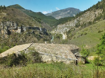
The profie starts in Verchent, where there is
also a bridge across the river. The road follows a
narrow valley, sometimes through tunnels,
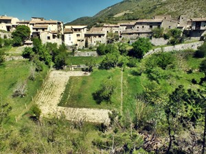
sometimes under alcoves to an old village, draped
over a low ridge along the river, Benoit en Diois,
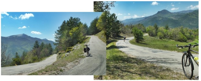
The turnoff to Col de Pennes follows a few km
later, and it can be quite a shock to the system -
steep - narrow -winding. The surrounding hills
take their place as green oval shapes in the
larger view of the landscape. The top of the pass
is still below treeline
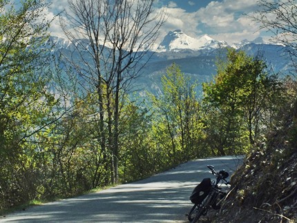
From East. (described
downwards) The views of snow covered peaks to the
north are broken into fragments by a dense
canopy of trees. Actually the best views I found,
are partly down on this side, following an unpaved
turnoff for a 100m or so. Some of the pictures are
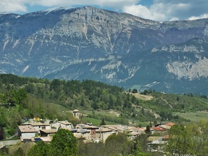
taken there. At the foot of the mountains lies
another picturesque village to be rolled through:
Barnave.
Dayride with this point as highest summit: COMPLETELY PAVED: ( < Col de Menee | Tour Madeloc s(u) > ) Col de Pennes: Die > Pontaix > St Benoit in Diois > Col de Pennes > Barnave > Quant > back to starting point in Die: 37.7miles with 2855ft of climbing in 3:56hrs (garmin etrex30 r5:19.5.1) |

|
|
advertisement |
|
|
advertisement |