| |
| |
Rossfeldstrasse s(u) Sometimes it seems -
whenever the alps get really interesting
heading south, you cross into Austria.
Berchtesgaden is the most famous
exception. The most rugged peaks, the
biggest precipices and the most
interesting roads are on the German side.
The area contains the only German national
park in the alps, and this is the highest
paved summit in it. It is also the
highest, paved through going road in
Germany. On the negative side, there is a
lot more traffic here too. Maybe because this is the
only real chance for a steep alpine road
in Germany, Rossfeldstrasse was made to be
particularly memorable when it comes to
steepness. Actually it is a ring road that
stays at high elevation. But in order to
get maximum elevation gain to the summit I
included approaches from two lower point.
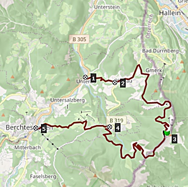
The ring road connects between points 2
and 4.
From
South. (described downwards) From the
summit, the eyes wander over partially cloud
obscured, vertical cliffs of various
mountains named after varieties of
"Freieck". After a steep decent in the
forest the road passes an interpretive
center for the Kehlheim Haus area. The
English designation for this is "Eagles
Nest" and has nothing to do with the
original name. It refers to Hitler's alpine
retreat. At the interpretive center tourists
wait to be taken in busloads from the
especially built bus terminal up the steep
mountain road. Access to that road is hidden
behind the bus terminal. Bicycles and
pedistrians are not allowed on this steep,
narrow and scenic road. But during Corona
times, there were no buses, and nobody there
to stop cyclists. Unfortunately I missed it.
I'll have to settle for a photograph of
somebody waiting for the bus instead
(picture is in the slideshow). Past that strange figment of
suburban tourist mass transit complex, more
steep descending is to be done to reach
Berchtesgaden. Technically this is not part
of the Rossfeldstr.
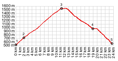
Dayride with this point
as highest summit:
COMPLETELY PAVED ( < | Schwarzbachtalwachtsattel > ) Rossfeldstr s(u): additional out and back : campground on a small rd several hundred ft above Oberau > Rossfeldstr s(u) > sightseeing detour around Berchtesgaden <> out and back to Koenigsee with detours around the area > Unterau > back to starting point: 29.6miels with 4400ft of climbing in 4:06hrs (gamin etrex 30 r4:21.8.6) Notes: day also included an introductory walk in the Koenigsee area 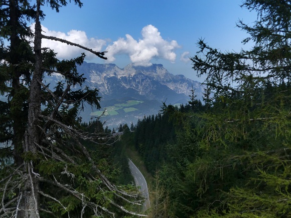 |
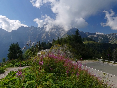 Not until just
before reaching the summit, does the road go
above treeline. From the summit ridge a
short walk gives a panoramic view down into
the valley of the Salzach in Austria. The
view onto the lower karst ridges with the
steep strike slope facing the viewer from
Berchtesgaden is actually much more
dramatic.
Not until just
before reaching the summit, does the road go
above treeline. From the summit ridge a
short walk gives a panoramic view down into
the valley of the Salzach in Austria. The
view onto the lower karst ridges with the
steep strike slope facing the viewer from
Berchtesgaden is actually much more
dramatic.|
|
advertisement |
|
|
advertisement |