| |
| |
Col de Vergio
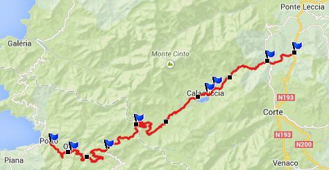
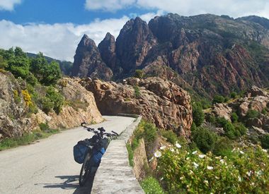
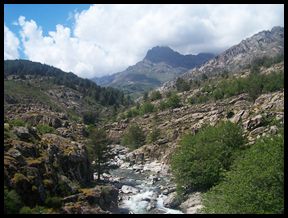
The town Porto is, let's say - in my opinion "understated". You have to look for it somewhere next to the road. But in spite of this - whichever direction you choose to approach Porto or leave it, you find an incredible, spectacular natural setting. That goes not only for the two routes along the coast, but also this one, which crosses to highest paved pass in Corsica. But even if it is the highest pass, the high point of this ride, for me was the limestone canyon that ends in Porto.
D84 slowly winds higher, crossing small but
massive stone bridges periodically. Meanwhile wild
pigs sleep by the roadside, tourists stopping to
marvel at the landscape and the pigs, while clouds
get tangled in the sharp limestone needles above.
Slowly the road winds to the level of these
coastal peaks. By the time Evisa is reached the
peaks form a background against a wall of blue sea
behind them. After Evisa the road enters quiet
forest of old-growth high fir trees, and stays in
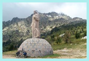
this green tunnel till almost the summit. On top is a curious monument, that apparently is
supposed to be a portrayal of Jesus, if you
believe what you read. Under it is enough parking
space, to accommodate an entire sports car rally,
several touring cyclists and a large variety of
other visitors. Most everybody seems to comment on
the fact, that the lake with its damn below on the
east side is well visible, rather than on the
somewhat bewildering, yet interesting statue at
the summit. The GR20 hiking route also crosses the
road here.
From East. (described
downwards) The slope is gentle enough you hardly
ever need brakes, even on a fully loaded touring
bike. Below St Pancrace the wide open valley
descends into a narrow limestone gorge and the
road once again takes its surface between walls.
But this time it stays close to the bottom of the
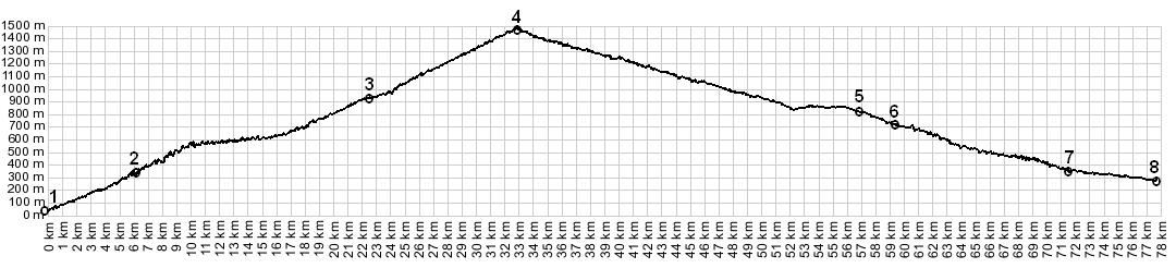
canyon. The profile descends to the jct with N133.
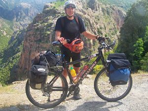
My own route turned off to Castirla shortly
before. COMPLETELY PAVED: (< Belvedere
de Saliccio s(u) | Col de Bigorno
> ) A Dayride from the starting point of this day, Piana, is on pags: Col de Sevi
|
|
|
advertisement |
|
|
advertisement |