| |
| |
Pete's Summit
This is a forested summit between
two stark dessert valleys. It's claim to fame is a
cave with petroglyps near the top. A quiet forest
campground at the top invites for a visit.
From East. Monitor Valley Road ( for some
reason labeled Belmont Road on Google maps) runs
south from US50 between the Monitor range and the
Toquima Range. The de Lorme Gazeteer map shows
this road crossing something called "Bottle Pass".
But this is not really a pass and the descent on
the southern side is less than 200ft before the
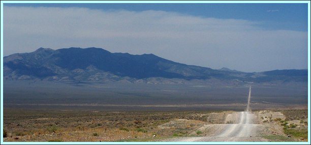
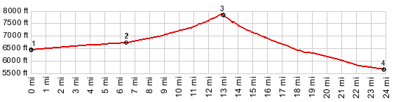
road climbs again to a higher elevation. The elevation profile begins at a low point along
this road. With a hot wind blowing from the south,
two mountain ranges left and right disappearing
into a blue fuzed haze, not a tree in sight, just
sagebrush as far as the eye can see, this must be
one of the more hopeless seeming point around -
either that or awe inspiring - I can't make up my
mind. The only human structure of the day comes nearer,
a collection of buildings labeled Monitor Ranch on
the map. But before reaching them the profile
takes a hard right, and starts climbing towards
nothing more than a distant lip of green trees.
Well - at least there's hope of reaching some
shade by lunchtime. The climb is gradual enough,
but the heat makes it seem like a workout anyway.
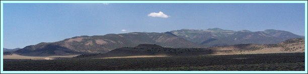
Later in a dense juniper forest the road quickly
reaches a pass. There is a national forest
campground without water at the summit, and also a
short trail to a cave with petroglyphs. - No real
far views to either side
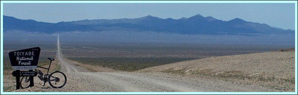   second picture from below is taken on the lower eastern approach; all others: lower western approach From West. (described
downwards) But after starting the descent on a few
turns on red, dusty earth, you see what lies ahead
on this side. The ground seems so dry that it
might turn into powder and blow away at any time.
Emerging from the hills, a single straight line,
many miles long shoots through the dessert floor,
here called the Big Smoky Valley, heading
unperturbed for the next gap in the mountains to
the west, an equally smoky set of mountains, the
Toyabee Range. The profile ends at a a low point
on that road. Dayride with this point as highest summit PARTIALLY PAVED / UNPAVED (< Little
Antelope Summit | FR002
Toiyabe Range s(u) >)
|
 Approaches
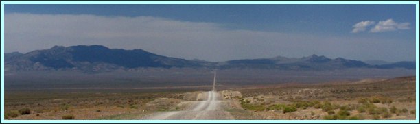
|
|
advertisement |
|
|
advertisement |