| |
Salt Creek Summit
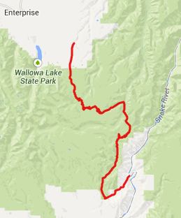
FR39 between Joseph and Hells
Canyon goes over three summit points. The
highest one, also the one closest to Joseph is
Salt Creek Summit. There is no sign at the
top, and it is not marked on many maps. But
signs in the area refer to it by this name.
The most memorable thing about this summit is
the sheer size of the descent to the bottom of
Hell's Canyon. Many maps advertise a 5000ft
drop at this place. But the drop in the road
does not quite reach that figure.
From West. The turnoff
from Wa350, west of Joseph onto the forest road
is signed "Wallowa Mountain Road". One can get
an idea of the surrounding mountains for a short
time, after the road crosses into the National
Forest. It looks more like a timber management
area. After that the road stays in forest until
after the 3rd summit. The climb to the first and
highest top seems to stretch forever as there
seems to be always just a little more shallow
hill to go. At the top is the signed turnoff to
FR3940 to Hart Butte, as well as the "Salt Creek
Summit Recreation area". I think it's a fishing
pond. From East. (described
downwards) After the first shallow downwhill the
road soon starts climbing again and reaches a
second summit, very similar in appearance to the
first, except here FR3930 and another forest
road join the paved road. The two are so similar
that I completely forgot about this point during
the way back, on my out and back ride. Using
paved roads the western side of this second
summit is just under 500ft tall. But one could
find a larger approach using dirt roads. Continuing on the profile, the
road descends to the Imnaha River in a long
downhill with one or two switchbacks, and
innumerable smaller turns. The dense forest in
this peaceful valley has two organized
campgrounds, in addition to the plentiful other
camping opportunities.
Once over the last and lowest
summit point, the road actual breaks out of the
trees for several turns, and you can see a
sliver of a ridge, crested by an outline of
trees to the west. But soon the road is in
forest again following Gumboot Creek. The road
is shallow enough that the bike just rolls along
perfectly on its own, no breaks required, and
pedaling would not bring much either. Several
miles before exiting onto Or86 all this public
land freedom is over, and the road crosses land
owned by a private ranch. Surprise, Or86 at the next
junction is a regular road - not some isolated
canyon track. Here cars go the speed limit
again, and this takes a while getting used to
after all that peace and quiet. The profile
descends all the way to the bridge over Hell's
Canyon at Copperfield. Calling it a canyon here
is somewhat misleading. There is no drop left
down into it. The canyon is above, and the river
is really a damed lake, used for power
production. Copperfield has a a campground with
perfectly manicured, green lawns, as well as
housing and churches for people who keep up the
power generation, dams and lawns. Dayrides with this point as
highest summit: PARTIALLY PAVED / UNPAVED ( < Junior Point /
Shady Pass | FR39 s(u) -2 (same page) >
) ( < Salt Creek Summit (same
page) | Brownlee
Summit > ) 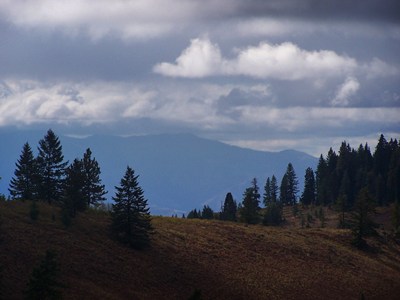 -
|

 Approaches
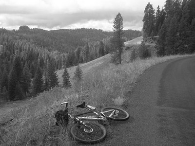 The climb to the third summit
(I'll call this one FR39 s(u)-2 soon feels quite
a bit steeper than the other two. If one wants
to see what's behind all those trees, the
turnoff to the Hell's Canyon Overlook (see
The climb to the third summit
(I'll call this one FR39 s(u)-2 soon feels quite
a bit steeper than the other two. If one wants
to see what's behind all those trees, the
turnoff to the Hell's Canyon Overlook (see
|
|
advertisement |
|
|
advertisement |