| |
| |
Mineral Bottom Road s(u)
This road connects Ut313,
"the island in the dessert - I mean sky" road with
the northern descent to the Green River of the
White Rim Route. As is the rule rather than the
exception in this area, the summit point on the
mesa often not even enters the awareness of the
passing cyclist, who is fixated - with good reason
- on the canyon bottom portions of the White Rim
Trail, and the passage to that portion.
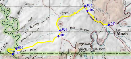
From East. The profile shows the most direct
way to approach this point, which is paved Ut313.
The most common way to approach it on a
bicycle is via the Shafer Trail on the White Rim
Route. Another feasible option is to approach the
summit via the Gemini Bridges Road. Whichever way
you use to get there, close before the highest
point on Ut313, a hard straight dirt road turns
off towards the west. It is signed as Mineral
Bottom. It rises just a little higher than the
turnoff point on Ut313. During late light the view
the veiw north from here reaches all the way to
the Roan Cliffs and their northern bend, behind
the town of Green River.
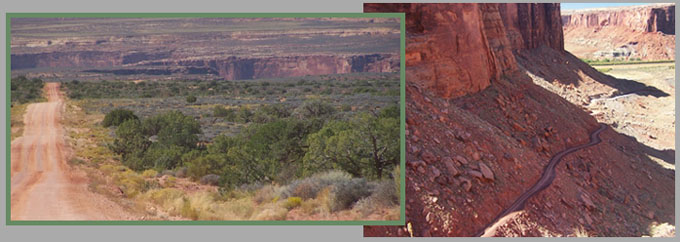
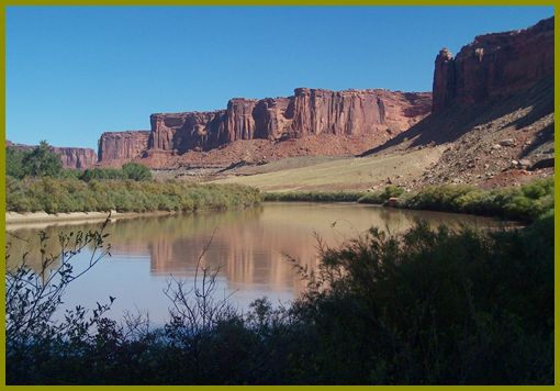
From West. (described downwards). It's a
lightning fast pedal down the barely sloping,
straight road, filled with anticipation of what
the canyon rim will bring. Actually you loose
almost a 1000ft before you get to the rim, which
is about half of the total altitude loss on this
side. Even past that the road surface remains in
good condition for the switchbacks down to the
Green. It was orginally built in the 1940s to
create access for mineral exploration. Down in the
canyon, it seems like every turn of the river
marks the beginning of another named "bottom".
Mineral Bottom, which the road uses for its name
is actually off to the right. But the profile
turns left and follows on long switchback of the
Green along Horsethief Bottom, Woodroff Bottom on
the opposite side, Point Bottom, Saddle Horse
Bottom. It is difficult to think of this as the
end, when the most visually compelling portion has
really just begun a few miles back. But the
profile labels this as the end of the climb.
Dayrides with this point as intermediate
summit point: PARTIALLY PAVED / UNPAVED
back to cycling Utah's summits and passes |
||||||||||||||||||||||||||||||||||||||||||||||||||
 Approaches
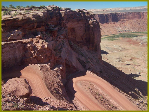
|
|
advertisement |
|
|
advertisement |