| |
| |
Sardine Summit
Sardine Summit is a
busy highway connecting Cache Valley with the
Wasatch Front, by skirting between the Wasatch and
Wellsville Ranges. It has grown into a four land
highway with a full lane sized shoulder. The
shoulder seems like a safe place to be with a
bicycle. The summit is named in older National
Forest maps.
From North. The most far reaching view is
at the bottom before entering the canyon, a
perfect vantage point during late light onto Cache
Valley backed by the Bear River Range. You can
make out the tabernacle on a prominent bench in
front of the mouth of Logan Canyon. Compared to that, the canyon about to be entered
on this ride is lush with vegetation. It hints at
an increase in precipitation over the summit.
During winter snowfall increases drastically at
this point. During the short climb the road only
encounters one wide curve to the summit, then a
dip through wetlands and over the top. The summit
is not signed but coincides with the crossing
between Box Elder and Cache counties, which is
signed. Down South. (described downwards) The
road passes Mantua with its reservoir and quiet
streets. It feels like still a world removed from
the suburban growth of Cache Valley. Then a short,
straight descent leads into Brigham City. I has
one of the nicest old western main streets, that I
know.
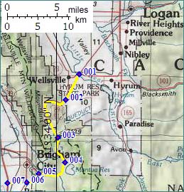
Dayride with this pass as highest summit: COMPLETELY PAVED: Sardine Summit , Ut38 Riverside - Petersboro
s(u): Mantua > Brigham City > Ut38
Riverside - Petersboro s(u) > North Logan >
unspecified detours as part of a sightseening tour
of Cache Valley towns between Logan and Hyrum on
sideroads > Sardine Summit > back to the
starting point. 84 miles, 3800ft of climbing in
6:4 hours (VDO MC1.0 m3:07.06.8). 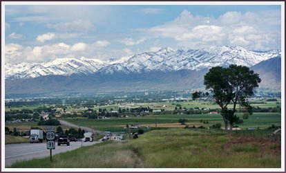 Cache Valley before starting a climb to Sardine Summit 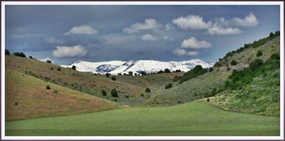 A rare glimpse of the Bear River Range, while cycling up Sardine Summit
back to cycling Utah's summits and passes |
 Approaches
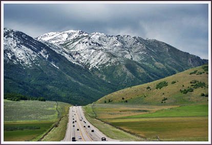
|
|
advertisement |
|
|
advertisement |