| |
| |
FR53 Muddy Creek s(u)
This dirt road summit was
necessary to make a loop over Shady Pass.
But it would also make a pleasant ride by
itself.
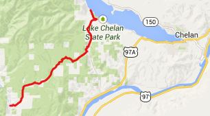
From North. The turnoff
from Entiat River Road onto Mud Creek Road is
clearly signed. If coming down from Shady Pass,
once you reach Ardenvoir the turnoff has been
missed. The first tight twists and turns
up a matchstick forest canyon are paved. Then
the road continues to climb gently on dirt. A
number of intersections, that allow connecting
with other roads up to Slide Mountain are
signed. The profile just stays on FR53. On top
there are numerous meanders that keep the slope
manageable, even after a long day of climbing,
and you just want to get back to the starting
point. The top is in open prairie country. From South. (described
downwards) The road surface seems quite a bit
rougher and more graveled on this side. But
maybe I just was going faster because I really
wanted to avoid riding in the dark. Early during
the descent, two dirt roads merge from the
right. The last part is fast traverse
paralleling Wa971. FR53 meets Wa971 south and
roughly 400ft below its summit. A Dayride with FR53 Mud
Creek as intermediate summit is on page
: Junior
Point s(u) , Shady Pass -
|

 Approaches
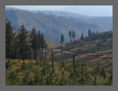
|
|
advertisement |
|
|
advertisement |