| |
| |
FR9712 Table Mountain
Road s(u)
This is a steep relentless
climb in the Wenatchee Mountains. It has a
view from the top that lasts as long as the
traverse over the plateau, and that can be
quite a while.
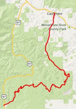
From West. There are many
options for the lowest part of this climb. The
option I took was to get away from traffic
plagued US97 as early as possible and ride up
FR9718 to Liberty. The road is paved until it
exits from this small collection of fixed up old
houses. A good climbing work out on a good dirt
road leads to the junction with FR9712. All
other options for the lower part of the climb
meet here. From shortly before this spot you can
see Mount Rainier as well as the first view of a
rocky ridgeline to the east, which I think is
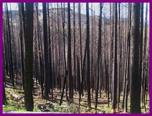
Manatash Ridge. Shortly thereafter the road enters
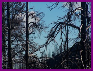
the Table Mountain Burn area. The treetrunks
still stand. They are just a lot blacker and
deader. The road becomes rockier and starts a
traverse to climb the major step onto the table,
its top a thick layer of dark volcanic rock. It
would be called black instead of dark in most
places. But the charred forest is so much
blacker in comparison. The panorama of distant
Manatash Ridge only gets better. Far below you
can make out US97, and its nightmare traffic
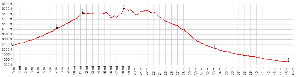
from a safe distance. Once on top of this step the road
reaches the first of many apparent summit
points. This one is the junction with FR35, well
signed as leading to Ellensburg. But the road
descends ever so slightly leading to a horse
camp and a wild mountain meadow, named Haney
Meadow, fronted by roadsigns. According to the
sign Ellensburg is 34 miles away and Wenatchee
only 21. But I think the trip to Ellensburg
would still be a lot quicker, considering the
road that is ahead. Meanwhile the burn area has
subsided, while the road potentially traverses a
wet area with puddles across the entire road.
Another point that feels like a potential summit
to the first time visitor passes, and now the
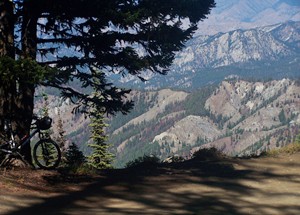
road clings to the edge of the plateau,
delivering grandiose views of the landscape to
the north and west, which - surprise - is not an
endless forest, but an endless conglomeration of
dessert hills and plateaus, with slivers of the
town Wenatchee appearing between them. I may have forgotten a potential
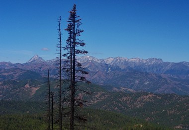
summit point or two, but the point that turns
out to be the real one, is a small sharp divide,
away from the edge, when the dark volcanic pile
of Wenatchee Mountain (6742ft) comes in full
view for the first time. The top of this
mountain has been visible for quite a while
before reaching the summit, evoking the
sentiment - I hope the road does not go up
there, because that would take a very long time.
But reaching the summit is the first time the
entire mountain becomes visible. Meanwhile the
road again goes through the center of the fire
area.
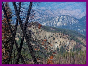
From South. (described
downwards) The road descends about 500ft, again
clinging close to the edge of the plateau,
rearranging the same photogenic landscape
subjects into a different order. On this side
too there are several false summits. But as
Wenatchee draws closer, the road becomes better,
as evidenced by more cars parked in the woods. At this point I ran out of time to
complete the descent shown in the profile. But
the profile goes down all the way the planned
route to Cashmere. Attempting to ride this route
from the other direction I missed the turnoff at
point 5. This is very easy to do since 99
percent of the traffic goes direction Number 2
Canyon. Dayride COMPLETETLY UNPAVED ROADS: ( < FR9718 -
9712(sh) | Rainy Pass
> ) |
 Approaches
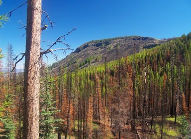
|
|
advertisement |
|
|
advertisement |