| |
| |
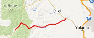
White Pass
White Pass parallels the
higher Chinook
Pass in Mount Rainier National Park. I
would guess that it sees a lot less bicycle
traffic than Chinook Pass.
This road has heavier and faster motor
traffic. But I think I got the best pictures
of Mount Rainier overall, from a viewpoint
along this route.
From West. When Wa123
turns into Mount Rainier National Park, away
from busy US12 over White Pass, it is very
tempting to take the turn. But the ride over
White Pass can have its interesting sides too.
At first it does not look very appealing, when a
sign promises passing lanes for the motorists
over the next three miles. But, surprisingly the
spacious shoulder for cycling remains, even as
the passing lane is added. In many other parts
of the country, the shoulder would be sacrificed
for the passing lane. But this road is
mercilessly straight, and so every contraption
towing vehicle seems to be floored, so that the
noise reminded me personally of cycling in
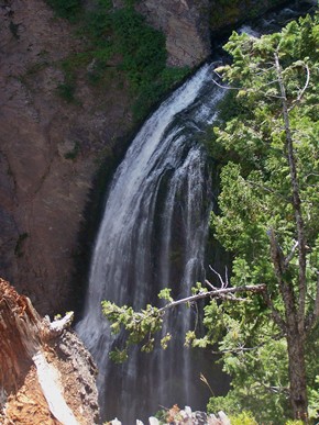
Mexico. There are a few points to keep you
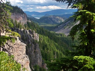
entertained. First a viewpoint onto lava
columns, then an unannounced waterfall, and best
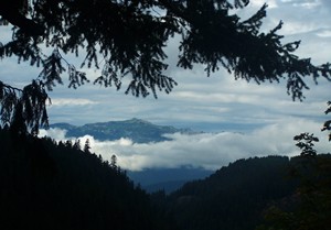
of all, for me the best reason to ride this
pass, the hope for an unusually spectacular far
view onto Mount Rainier, as it deals with
eggshells of complex clouds, that are different
during every weather pattern. Photos from two
different visits to this point are in the slide
show below. All of these are extreme telephoto
shots. Many visitors never paid attention to the
mountain, as they happily photographed each
other standing in front of it. After that excitement the road
leads uneventfully to the top. Just one more
short view of a few Cascade peaks above
treeline, and the road reaches the ski area /
gas station, selling food on top of the pass.
The Pacific Crest Trail also crosses this broad
wooded expanse. From East. (described
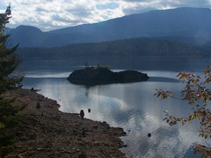
downwards). Another waterfall together with a
view down the long wooded valley to Rimrock Lake
is another reason to stop and wander along the
edge of the lava for a while. After that a long
straight traverse quickly shoots down to the
aforementioned lake. Tieton Road around the
south side of the lake is a nice alternative to
US12, also quite a bit longer and a bit more up
and down. The turnoff is easy to miss during a
fast downhill. The sign simply reads :"Rimrock
Recreation area".
Dayride COMPLETELY PAVED: ( < Cayuse Pass
| Blewett
Pass > ) -
|

 Approaches
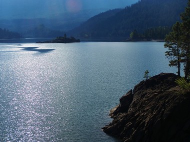
|
|
advertisement |
|
|
advertisement |