| |
| |
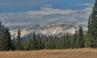
Snowy Range Pass The major ranges in the eastern
two thirds of Wyoming are big rounded masses of
rock in the shape of sleeping elephants, but
only when seen from the hazy distance. They lack
the sheer vertical drops of ranges further west.
But these mountains, that block the free flow of
east west traffic for hundreds of miles, involve
some big climbs. One reason for the existence of
roads through these mountains is, that at least
the eastern ranges are rounded enough that roads
can climb them more easily. Snowy Range Pass is
the highest of these eastern Wyoming passes.
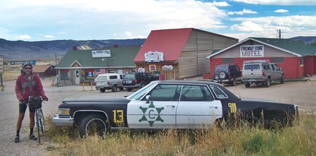
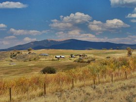
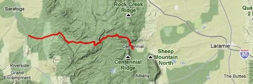 Approaches From East. Wy130 leads from Laramie to Centennial through a stark, treeless landscape typical for eastern Wyoming. Once the Laramie Mountains come into sight they stay there, and the shape of a gigantic wave of rock, breaking on the shore of a sagebrush dessert is a captivating sight. Passing through the collection of buildings that are Centennial, the trademark fake police car with the strange markings including a 911 decal is still there. It once had a fake Indian sitting in the driver's seat, but that police car from the 80s has been replaced with a newer, more respectable Cadillac.
Tours Dayrides. An out and back ride: Centennial
<> Snowy Range Pass <> jct Wy130 -
Wy230, including a short additional approach from
FR338 measured 80miles with 7600ft of climbing in
7hours, on a very windy day in September, but
windy days are common here. The climbing altitude
may be somewhat inflated due to the windy weather. Three Day Road Tour: A
three day tour, dubbed the Cowboy loop by DBTC
Denver city slickers was as follows: day 1:
Laramine > Snowy Range Pass > Saratoga. day
2: Saratoga > Walden (Co), day 3: Walden >
Foxpark Divide > Laramie. (m1:88.07.02-04)
 |
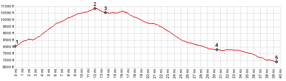
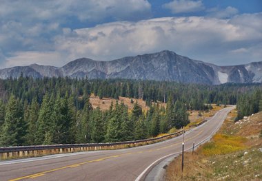
 From Centennial the road starts a
short steep climb to where it enters the forest.
The bulk of the ride is a long, uniformly climbing
forest road with few if any landmarks. Then, all
of a sudden the road enters a clearing and the
summit ridge of the Snowy Range can be seen ahead,
a lip of rock that stretches the width of the
view. The road passes to the south of the main
ridge and reaches a high point. There is no pass
sign and the short, very scenic portion of the
trip starts from here. For the next few miles the
road remains at or above treeline.
From Centennial the road starts a
short steep climb to where it enters the forest.
The bulk of the ride is a long, uniformly climbing
forest road with few if any landmarks. Then, all
of a sudden the road enters a clearing and the
summit ridge of the Snowy Range can be seen ahead,
a lip of rock that stretches the width of the
view. The road passes to the south of the main
ridge and reaches a high point. There is no pass
sign and the short, very scenic portion of the
trip starts from here. For the next few miles the
road remains at or above treeline.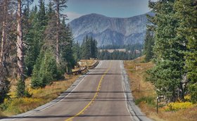
|
|
advertisement |
|
|
advertisement |