| |
|
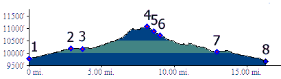
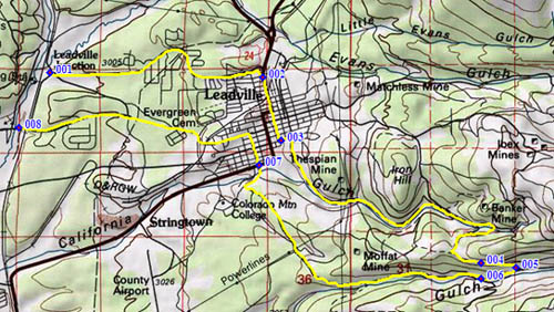
1.(9770ft,mile00) START-END NORTH : Leadville Junction, jct northern access road to Turquoise Reservoir - CR9
2.(10190ft,mile03) join Leadville Main Street, Co91
3.(10160ft,mile04) turn left, then right onto CR2 California Gulch
4.(11180ft,mile08) TOP
5.(10900ft,mile08) going straight goes up Iowa Gulch to Iowa amphitheater. Profile stays right
6.(10720ft,mile09) left goes up towards Empire Gulch. Profile stays straight
7.(10060ft,mile13) cross Co91 on outskirts of Leadville
8.(9660ft,mile17) START-END SOUTH: southern access road to Turquoise Lake crosses Arkansas River.