| |
|
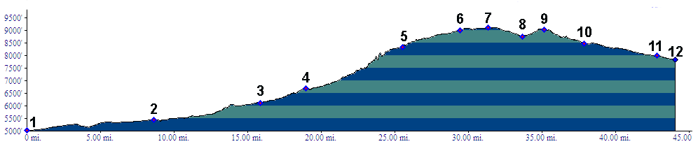
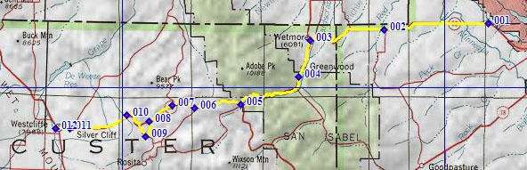
01.(5020ft,mile07) START-END EAST ALT: Co69 west of Canyon City, at junction with western access road to Pueblo Reservoir
02.(5450ft,mile) Siloam
03.(6100ft,mile) START-END EAST ALT: Wetmore and jct with Co67 from Florence
04.(6700ft,mile) road to Lewis Creek trail head is on right
05.(8340ft,mile) Mc Kenzie Junction
06.(9000ft,mile) Rosita Road takes off on right
07.(9100ft,mile) TOP: Hardscrabble Pass
08.(8750ft,mile) intermediate low point
09.(9030ft,mile) intermediate high point near site of Queriad and turnoff on right going towards Rosita Rd
10.(8470ft,mile) junction with CR260 Brush Hollow Road on right
11.(7990ft,mile) Silvercliff, center
12.(7840ft,mile) START-END WEST: Westcliff, jct with Co69