| |
|
|
|
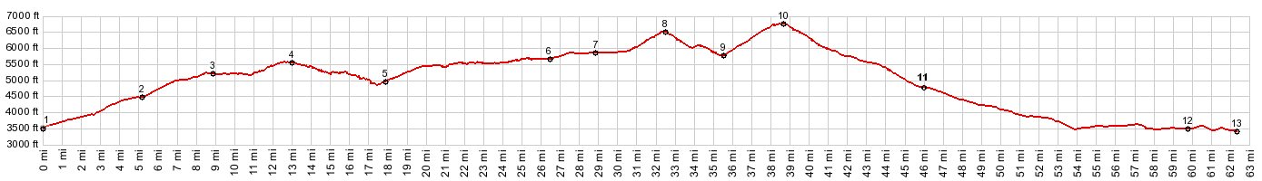
01.(3490ft,mile00.0)START-END WEST: jct I5-Ca89, just south of Mt Shasta City
02.(4470ft,mile05.1)profile turns left up Ski Park Highway on top of Snowman's Hill
03.(5240ft,mile08.9)route stays right onto FR31
04.(5620ft,mile13.0)intermediate summit FR31 s(u)-1
05.(4960ft,mile17.9)profile goes left onto FR31
06.(5700ft,mile26.5)profile turns left at this T junction
07.(5890ft,mile28.9)Military Pass Road stays left; profile stays right on FR19.
08.(6560ft,mile32.5)intermediate summit: FR19 s(u)-2
09.(5830ft,mile35.7)intermediate low point and jct dirt road going lower
10.(6790ft,mile38.7)TOP: FR19 Deer Mtn Rd s(u)
11.(4780ft,mile46.0)profile turns left onto US97
12.(3480ft,mile59.5) Carrick
|
|