| |
| |
FR19 Deer Mountain Road
This is an industrial strength
logging road. But before you say - get me out of
here as fast as possible - let me explain. I
really only saw two logging trucks during my
traversal of the road, and fewer than five other
vehicles. The road has excellent pavement and is
wide enough for big trucks. So the traffic issue
gets a check mark. There are few variations of the
same incredible view onto the north facing slopes
of Mount Shasta from this route. But it's a one
view ride. Besides the views from this half mile
long section, there is nothing but trees.
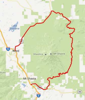
If you restrict yourself to pavement this is an out and back ride. But combining dirt roads with paved sections (the profile does this), this point can be the highest point on a complete loop around Mount Shasta. It's not the innermost loop, that would substitute Military Pass Road for this point.
From South. The description starts at
point 9, after coming down from summit FR19 s(u)-2. Just
after reaching the low point, the wide dirt road
starts climbing again, and well maintained
pavement appears out of seemingly nowhere. - What
a surprise that was. The road traverses up a ridge on Deer Mountain.
There are some stunning views of the steeper north
facing slopes of Mount Shasta, that quickly
disappear as the road winds around the north side
of Deer Mountain. From North. (described downwards). The
best thing about the fast curves through the
forest on this side is the absence of traffic. The
only driver I saw, blew his horn at me, as
greeting because he had seen me, when he was going
the other way. The road emerges on Ca97 near its summit. The
turnoff is well signed. The profile turns north
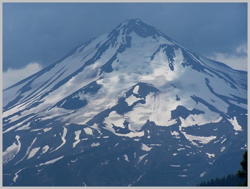
(left) again. The remaining descent has a
constantly open view of Mount Shasta to the left
and the hills of the Klamath Basin to the right.
Riding this section of road near the end of the
day, seemed like a victory parade to me. Another
interesting view is the straight-as-a-shot road up
Military Pass Road. The profile ends at the jct
with I5. Dayride PARTIALLY PAVED / UNPAVED ( <
Snowmans Hill s(u) | Grey Butte s(u)
> ) |
 Approaches
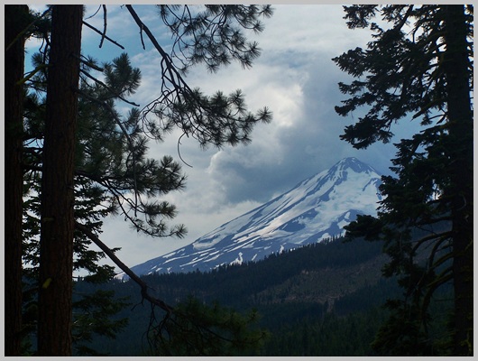
|
|
advertisement |
|
|
advertisement |