| B |
-PVD- |
Brockway
Summit -7179ft- busy road
with shoulder between Lake Tahoe and Truckee
|
|
-PVD- |
Carson Pass
-8574ft- the Sierra Nevada Range looks like
a big plateau from this wide major highway |
D
|
-PVD-
|
Daylight
Pass -4316ft- an entrance into
Death Valley from the east, reaching down to
260ft below sea level
|
|
-PVD- |
Donner
Pass -7135ft- little traffic,
great scenery, many bikes, not that much
climbing |
| E |
-PVD- |
Ebbetts
Pass -8730ft- a relatively
small percentage of paved roads in the US
seem tailor made for a bike ride, this is
one of them |
| F |
-UNP- |
Forestdale
Divide -8800ft- this point above
Carson Pass is a better vantage point on the
scenery |
|
-UNP- |
FR17
Lassen National Forest s(u)
-6190ft- this is a road through the
northeastern forests like many others. But
with it you can ride a loop ride over the
paved Lassen National Park Road s(u) |
|
-PVD- |
FR19
Deer Mountain Rd s(u) -6790ft-
The section over the summit is paved. But
using additional unpaved roads, this is the
highest point on a ride around Mount Shasta
|
|
-UNP- |
FR19 s(u)-2
-6560ft- an intermediate summit on a
partially unpaved ride around Mount Shasta |
|
-UNP- |
FR31 s(u)-1
-5620ft- another summit point on the ride
around Mount Shasta |
| G |
-TRAIL- |
Grey
Butte s(u) -8119ft- a high point
on the slope of Mount Shasta |
| L |
-PVD- |
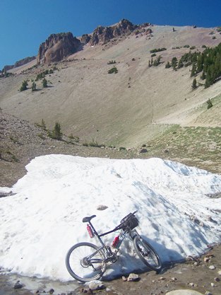
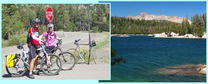
Lassen
National Park Road s(u) -8511ft-
a great way to get away from traffic hassles
in some of California's best scenery |
|
-PVD- |
Lassen
National Park Road s(u) -8511ft-
a great way to get away from traffic hassles
in some of California's best scenery |
|
-PVD- |
Luther
Pass -7790ft- a minor pass in
the Lake Tahoe area |
| M |
-PVD- |
Monitor
Pass -8314ft- not across
the Sierra Nevada Range, but a perfect far
viewpoint on them |
|
-PVD- |
Pacific
Grade Summit -8050ft- the
unusually, steep and curvy eastern side of
this pass adjoins Ebbetts Pass |
|
-PVD- |
Packsaddle
Pass -7210ft- the major
attraction is the relative isolation and
narrowness of the road |
| S |
-PVD- |
Snowman's
Hill s(u) -4470ft- a point on
the slope of Mount Shasta, start point for
many unpaved higher rides |
T
|
-TRAIL-
|
Tahoe
Rim Trail: section Armstrong Pass -
Daggett Pass -9740ft- this part
of the TRT summits below the highest peak on
the east side of Lake Tahoe |
|
-TRAIL- |
Tahoe
Rim Trail: section Big Meadow Th -
Armstrong Pass -9500ft- follows
near the ridge line south east of Lake Tahoe
|