| |
| |
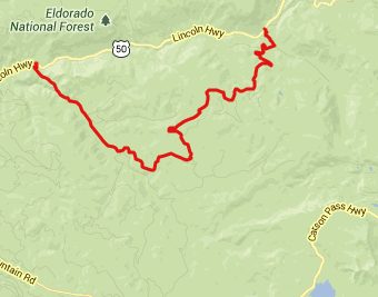
Packsaddle Pass
I found this little pass by
accident. It is only labeled as Packsaddle
Road in de Lorme Gazetteer maps. It turned out
to be the best part of a day long loop ride -
not because of awe inspiring vistas, but
simply because of peace and quiet in the
forest, a steep road in harmony with the
landscape around it, and only a single other
vehicle (a motorcycle), that I saw on this
part of the ride. But there is also a quickly
fleeting summit view on the east side.
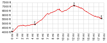
From West. The profile starts by going
up Silver Fork (of the American River) Road from
US50 in Kyburz. While cycling along on this
peaceful, smoothly paved forest road, you pass a
sign pointing steeply upwards. Packsaddle Pass
it reads. The road turns into a tunnel of green
vegetation, with a very variable grade and
curves that follow every whim of the landscape.
One more turnoff to the left, five miles below
the summit is necessary to stay on course. Again
it is clearly signed as Packsaddle Pass.
Approaching the top, a high bare cone of a
mountain becomes visible. I bet that exploring
the unpaved forest road spurs on the the top
would yield a better view, than from the pass
itself From East. (described downwards). But
from this road the view in the photo is probably
the best, one can expect. The road drops steeply
to US50. The turnoff from US50 on this side is
signed as "Strawberry Creek Tract" and "42
Milestone Tract". 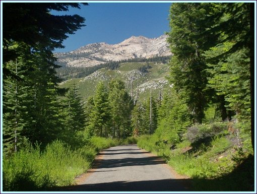 A Dayride with this point as
intermediate summit is on page : Carson Pass |
 Approaches
|
|
advertisement |
|
|
advertisement |