| |
| |
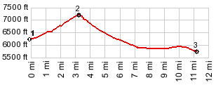
Brockway Summit
About the best thing I can find
to say about this summit is, that it is not
dangerous. There are no rumble strips and there is
a spacious shoulder. This is one of several very
busy access roads to the Lake Tahoe area, (the
others are Spooner Summit and Mount Rose Summit).
Of those three it is by far the lowest, and
scenically the least interesting. It probably also
caries fewer cars than the other two. But after
riding Brockway Summit in the summer and being
passed by thousands of cars, this may be difficult
to believe.
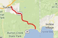
My favorite spot along this profile is at the start of the northern side, in King's Beach, watching the life on the water.
From North. Leaving King's
Beach a steady climb at uniform grade leads to a
sign saying "Brockway Summit", with housing
turnoffs. The only interesting view along the way
is from the turnoff to the Tahoe Rimtrail
trailhead, north east side of the road.
Dayride COMPLETELY PAVED: ( < Donner Pass |
Lassen National
Park Road Summit > ) |
 Approaches
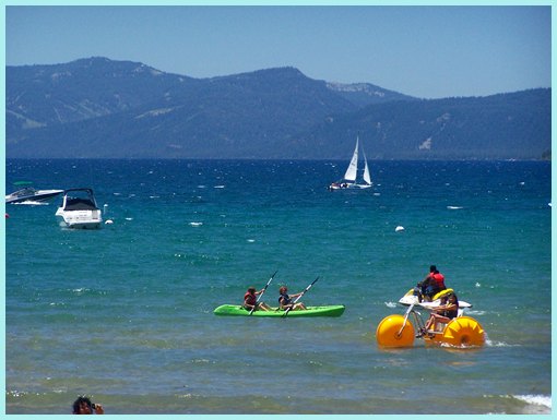
|
|
advertisement |
|
|
advertisement |