| |
| |
Lassen National Park road
Summit
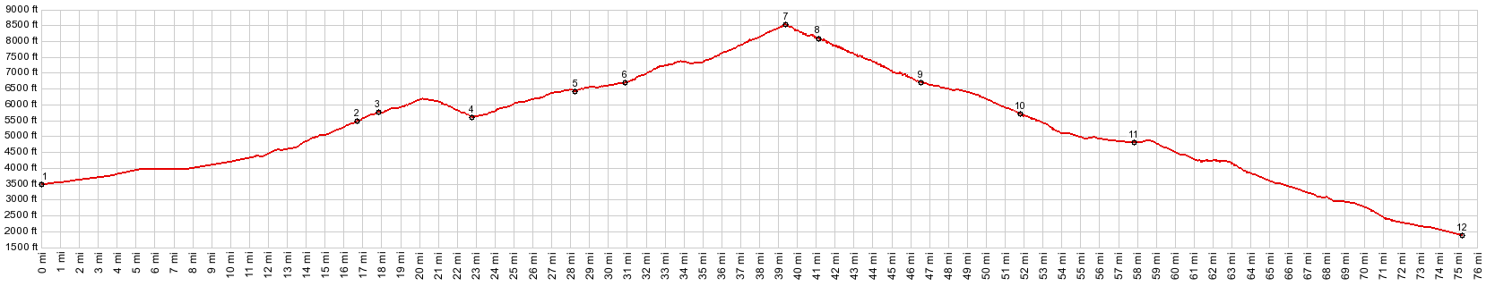
During a Friday in July I
encountered no other bicycles on this great summit
ride. On the same day Yosemite was probably so
crowded, hiking had to be rationed. Here there was
complete freedom from logging trucks, something
that I learned to value very highly, after having
spent only a few days in the general area. It
seemed like everybody was here to enjoy the
scenery, weather driving, cycling or hiking, and
what a scenery it was !
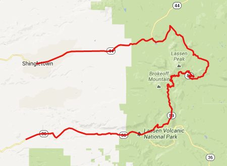
From North. From Shingletown, a wide road
through nondescript forest leads to the Ca89
turnoff into Lassen Volcanic National Park. Right
after entering the park the road passes Lake
Manzanita. Being here for the first time, this
looked liked the beginning of a great climb, so I
hurried past this spot. This was a mistake,
because this is actually one of the scenically
most charming places, that is right next to the
road. Yes - there was a great climb ahead, but I still
had to wait a while and suffer in the cloudless
summer heat, just to get to the start. Actually
the road descends more than 500ft from Lake
Manzanita. This makes the section of road up to
point 4, a summit by itself. This section of road
around point 4 passes a few distant views of
Lassen Peak. In the foreground is the socalled
"devastated area". Rolling along ever so gently, in between large
trees, campgrounds and the occasional parking lot,
the road takes its time till it presents a far
view to the traveller. Finally Lake Almanor comes
into sight in the distance, surrounded by aunthill
shapes in the haze. Fortunately the real estate
development complex on Peninsula Village cannot be
discerned. The road passes a single great view of
Lassen Peak. In the foreground is a swampy meadow.
Then the final assault on the summit starts. This
last part was quite a workout for me in all that
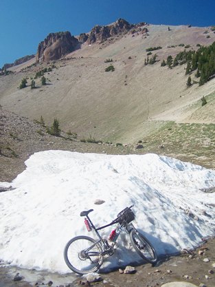
heat. On July 19th there were still a few lonely
snowdrifts left up here, even after weeks of
record heat and forest fires all around.
From South. (described downwards). There
is a huge parking lot shortly after the road
summit. This is also the start of a relatively
short foot trail, to climb the remaining ~1500ft
to the summit of the mountain with the same name.
During my visit the trail was closed far below the
summit of the peak, threatening prosecution if you
climb the peak anyway on this route or any other
route. There was no indication of this closure
available at the trailhead. Luckily the trail is
short, and there is not that much time to get
really pissed off at this. All in all - I think the road on this side is
quite a bit more interesting. The road threads
between two high mountain lakes, Lake Helen and
Emerald Lake, and then passes an area called
Bumpass Hell. Here outcrops of magma ridges mark
the outline of a higher ancestral volcano.
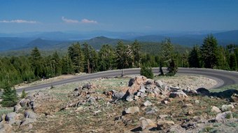
Sections of road, making almost complete circles,
can be seen looping down the mountain side in an
attempt to loose elevation without being very
steep - in the background: colorful lava rocks.
Lassen Peak keeps showing up in views when turning
around, apparently making up for its scarceness in
views on the other approach. The road also passes
a boiling mud caldron, not more than 3ft next to
the road, but properly fenced off, so you don't
burn your fingers while riding by. - So that's
where that smell of sulfur comes from, that I had
noticed for the last several miles. Past the park
entrance station a quick descent traverses though
forest to Morgan Summit. The profile goes right
onto Ca36 and continues to the intersection with
FR17 Dayrides. PARTIALLY PAVED / UNPAVED ( < Brockway
Summit | Snowmans
Hill s(u) > ) |
 Approaches
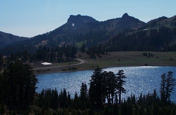
|
|
advertisement |
|
|
advertisement |