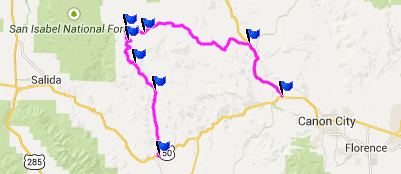
CR12 Firebox Road s(u)
This summit is located on a wide dirt road without
(or relatively little) washboard surface, on a
long range land ramble between South Park and the
Arkansas River. It's possible to construct
different loop rides over this summit from
opposing directions. Both of these that are about
equally long. The first option reaches to the
summit from the east and Co9. The second reaches
towards the summit from the west and Salida. The
profile shows an eastern loop.
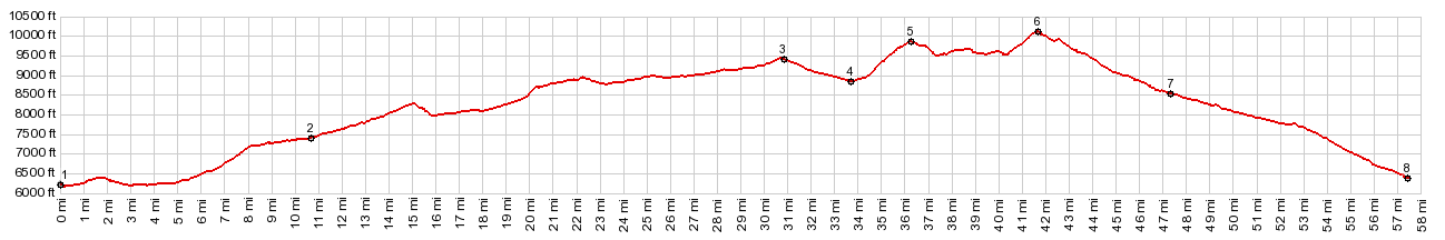 |
1.(mile00.6180ft)
START-END EAST: low point immediately
after jct US50 - Co9, on Co9 west of
Canyon City
2.(10.8mile,7430ft) profile turns left
onto CR2
3.(30.8mile,9440ft) CR2 Stirrup Ranch s(u)
4.(33.7mile,8840ft) profile turns left
onto CR12 Firebox Rd
5.(36.4mile,9860ft) intermediate high
point
6.(41.6mile,10090ft) TOP: CR12 Firebox Rd
s(u)
7.(47.4mile,8520ft) CR16 from Waugh Mtn
joins from left
8.(57.5mile,6380ft) START-END WEST: jct
US50 - CR12 and CR1A in Cotopaxi next to
Arkansas River |
 Approaches Approaches
From East. The description starts a short
distance before point 3. A wide dirt road climbs
over the sweeping range land in south park to a
summit on CR2. The road descends only a few
hundred feet.
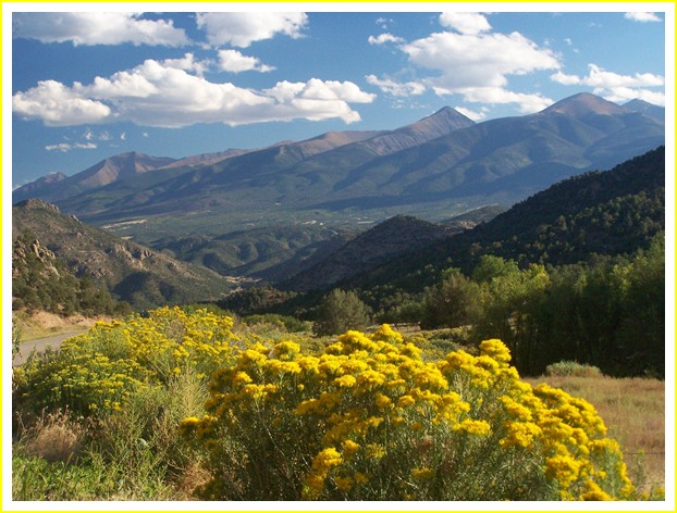
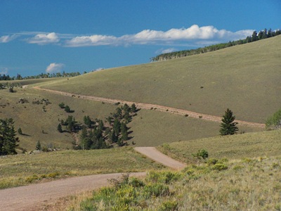
Now the profle turns left onto Firebox Road. A
short but steep climb leads to what I thought was
the summit. The Sawatch Range is shining in the
late afternoon light behind a line of aspen,
showing first effects of colder weather. But where
was the view of the Sangre de Cristo Mountains to
the south ? I should have known. The summit was
still miles away, even it it was only a couple of
hundred feet higher. But two sizable dips and
climbs, following the contour of Waugh Mountain
still had to be negotiated. The top is in the
trees, and the Sangre de Cristos still are not
visible.
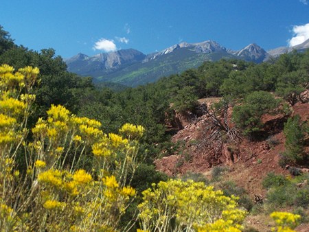
 From South. (described
downwards). This is a very fast descent on smooth
dirt. The last 1800ft vertical are paved, and are
the only portion where great views of the Sangre
de Cristo Mtns caused me to stop and take
advantage of the excellent late light (last
picture). From South. (described
downwards). This is a very fast descent on smooth
dirt. The last 1800ft vertical are paved, and are
the only portion where great views of the Sangre
de Cristo Mtns caused me to stop and take
advantage of the excellent late light (last
picture).
A Dayride with this point as
intermediate summit is on page: CR169 Waugh
Mountain s(u)
CR12
Firebox Rd s(u)
Highest Point: 10090ft
|
|
Eastern Approach:
|
climb |
over distance
|
drop |
low point immediately
after jct US50 - Co9, on Co9 west of
Canyon City (6180ft)
|
3910ft |
41+1/2miles
|
~2000ft |
jct CR12 Firebox Rd - CR2
Stirrup Ranch (8840ft)
|
1250ft
|
8miles |
~600ft |
Western
Approach:
|
|
|
|
jct US50 - CR12 and CR1A
in Cotopaxi next to Arkansas River
(6380ft)
|
3710ft |
15+1/2miles
|
|
|