| |
| |
FR260 Silver Lakes Road
s(u)
From the name you might
suspect some spectacular Albert Bierstadt
painting scenery. But words can be deceiving.
The map shows a lake or two next to the road.
But they are not silver, neither do they have
public access (that I could find). There are
three more lakes at some distance from the
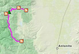
road. This lonely, winding dirt road connects
Alamosa Canyon with the valley of the Conejos
River over a pleasant forested divide, and
some wonderful rolling mountain scenery at the
top. It's an alternative to Stunner
Pass. It may look like it is shorter on
the map, but since it winds around like a
snake on acid, this perception is erroneous.
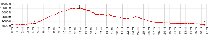
It also reaches roughly the same elevation as
Stunner Pass. The road surface on this route
is perfect for fast aerobic cycling all the
way: no washboard, no sand, no rocks.
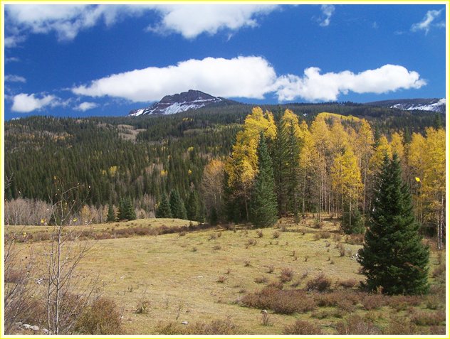
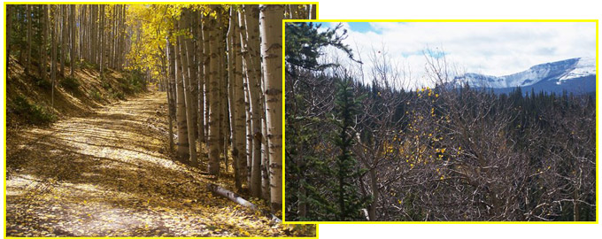
The beauty of this road is that it never goes straight, and the slope never stays the same. It is in a constant state of flux. What looks like the fist summit is a small open meadow. What looks like the second summit turns out to be the start of a hilly forest section. Here a picturesque cliff comes into view: Red Mountain (12018ft). The real summit comes at a point where several closed roads branch off. The spot is completely enclosed in forest
From South (described
downwards). On this side however the trees
become a little sparser and show off Red
Mountain from the other side. A quick descend
meets FR250 on the Conejos River at a wide spot. A Dayride with this point as intermediate summit is on page: Stunner Pass
- |
||||||||||||||||||||||||||||||||||||||||||||
|
|
advertisement |
|
|
advertisement |